

More areas under Signal No. 2 as Paolo moves closer to Luzon
Five areas in Northern and Central Luzon are now under Tropical Cyclone Wind Signal (TCWS) No. 2 as Tropical Storm Paolo moves closer to landmass, PAGASA said Thursday afternoon.
In its 2:00 p.m. PAGASA raised the following Tropical Cyclone Wind Signals:
Signal No. 2
- The central and southern portions of Isabela (San Mariano, Dinapigue, San Guillermo, Echague, Jones, San Agustin, Benito Soliven, Angadanan, Naguilian, Palanan, Ilagan City, Quirino, Mallig, Quezon, Delfin Albano, Tumauini, Cordon, City of Santiago, San Isidro, Ramon, Alicia, San Mateo, Cabatuan, City of Cauayan, Reina Mercedes, Luna, Gamu, Burgos, San Manuel, Aurora, Roxas)
- The northern portion of Quirino (Maddela, Aglipay, Cabarroguis, Saguday, Diffun),
- The northern portion of Nueva Vizcaya (Diadi, Bagabag, Quezon, Solano, Villaverde, Ambaguio, Bayombong, Kasibu)
- The eastern portion of Mountain Province (Paracelis, Natonin, Barlig)
- Ifugao
- The northern portion of Aurora (Dilasag, Casiguran, Dinalungan)
Signal No. 1
- Cagayan
- The rest of Isabela
- The rest of Quirino
- The rest of Nueva Vizcaya
- Apayao
- Abra
- Kalinga
- The rest of Mountain Province
- Benguet
- Ilocos Norte
- Ilocos Sur
- La Union
- Pangasinan
- The northern portion of Zambales (Palauig, Masinloc, Candelaria, Santa Cruz)
- Tarlac
- Nueva Ecija
- The rest of Aurora
- The northern portion of Bulacan (Doña Remedios Trinidad, San Miguel, San Ildefonso, Norzagaray, San Rafael)
- The northern portion of Pampanga (Magalang, Arayat, Candaba, Mabalacat City)
- The northern portion of Quezon (General Nakar, Infanta) including Polillo Islands
- Camarines Norte
- The northern portion of Camarines Sur (Siruma, Tinambac, Lagonoy, Garchitorena, Caramoan, Goa, San Jose, Presentacion)
- Catanduanes
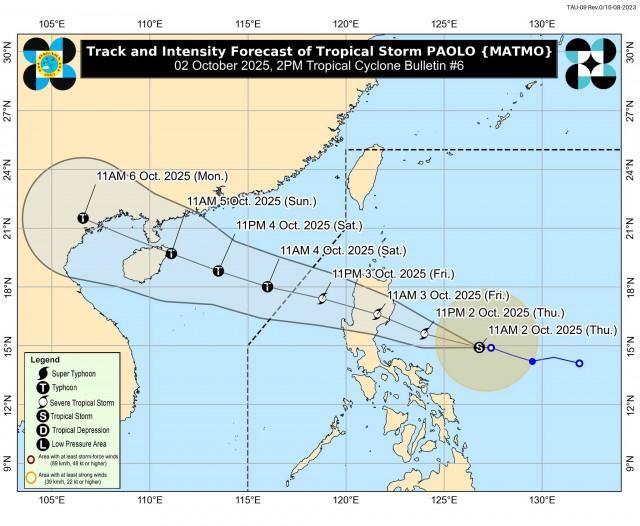
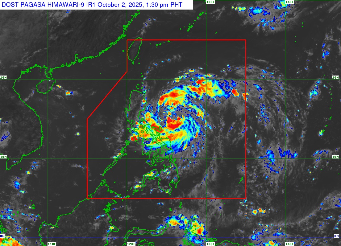
Paolo was last spotted 530 km east of Infanta, Quezon with maximum sustained winds of 75 km/h near the center, gustiness of up to 90 km/h, and central pressure of 998 hPa.
Paolo is forecast to make landfall over southern Isabela or northern Aurora on Friday morning, crossing Northern Luzon and emerging over the West Philippine Sea later in the day.
The storm is expected to intensify into a severe tropical storm tonight and could strengthen into a typhoon once it exits into open waters.
PAGASA previously said that Paolo is expected to exit the Philippine Area of Responsibility by Saturday morning. —VAL, GMA Integrated News
