

New tropical cyclone spotted as Paolo leaves PAR
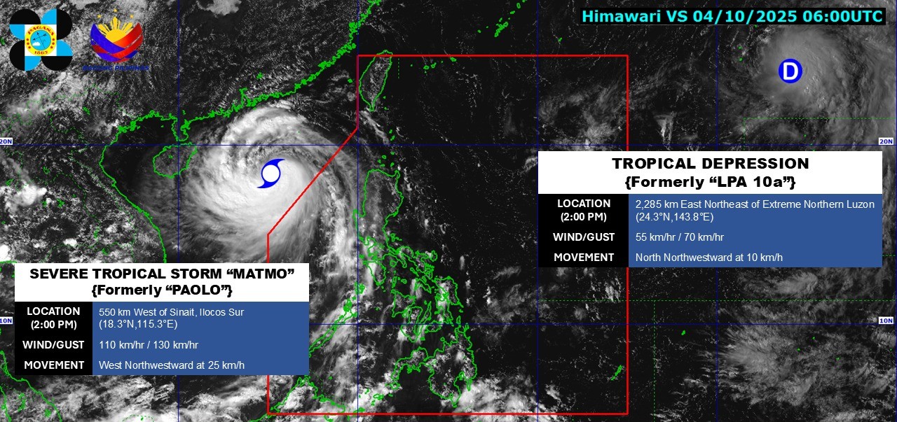
The low pressure area outside the Philippine Area of Responsibility has developed into a tropical depression, according to the state weather bureau PAGASA on Saturday afternoon.
At 2 p.m., the weather disturbance was located 2,285 kilometers east northeast of Extreme Northern Luzon, carrying maximum sustained winds of 55 km/h and gustiness of up to 70 km/h.
Traveling north northwestward at 10 km/h, the tropical depression is too far away to impact any part of the country.
Meanwhile, Severe Tropical Storm Matmo (formerly Paolo) was last monitored some 570 km west of Sinait, Ilocos Sur. It exited the PAR early Saturday morning.
In the next 24 hours, the Southwest Monsoon (Habagat) will bring cloudy skies with scattered rains and thunderstorms over Zambales, Bataan, Occidental Mindoro, and Palawan. The rest of the country will experience thunderstorms.
Winds will be moderate to strong in the northern and western sections of Northern Luzon, along with moderate to rough coastal waters.
The rest of the country will expect light to moderate winds and slight to moderate seas.
Sunrise in Metro Manila will be at 5:46 a.m. on Sunday. —VBL, GMA Integrated News
