

LPA outside PAR has 'low chance' of becoming tropical depression
A low pressure area (LPA) has been monitored outside the Philippine area of responsibility (PAR) that has a "low chance" of developing into a tropical cyclone in the next 24 hours, state weather bureau PAGASA said on Thursday.
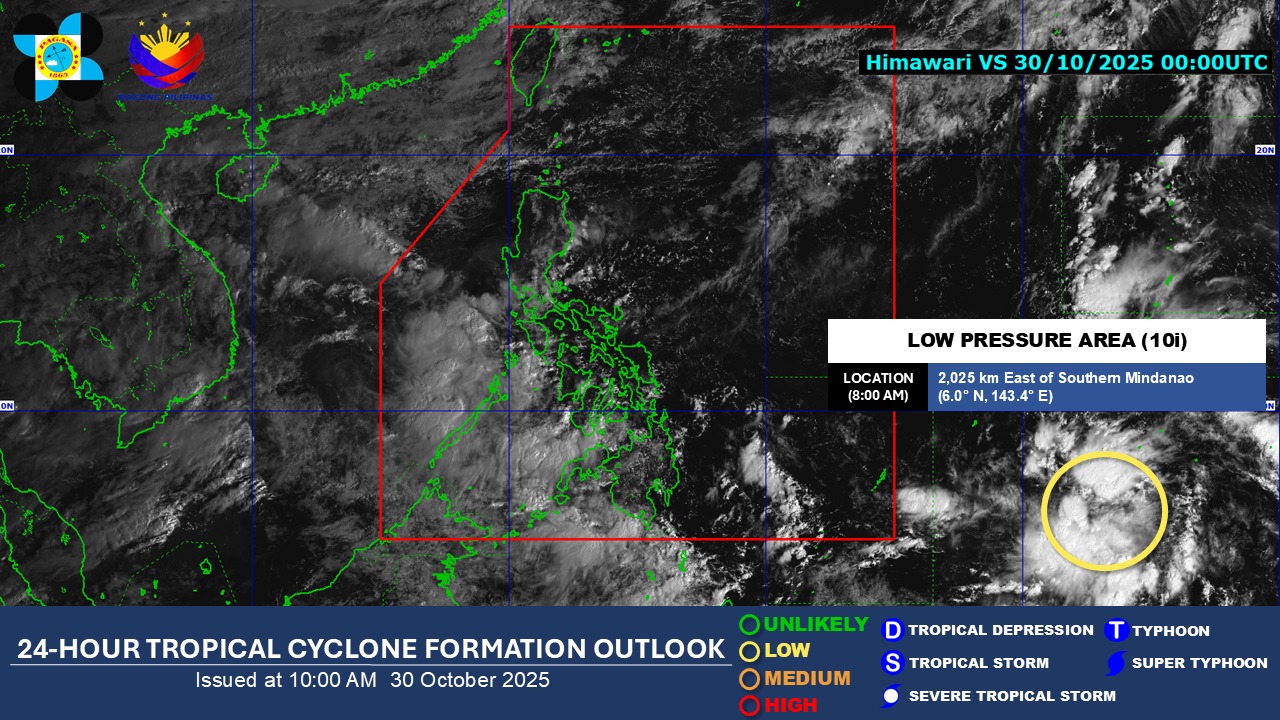
“As of 8:00 a.m. today, 30 October 2025, a low pressure area (LPA 10i) is being monitored outside the PAR and has a low chance to develop into a tropical depression within the next 24 hours,” PAGASA said.
The LPA was last spotted 2,025 kilometers east of southern Mindanao outside the PAR, according to the state weather bureau.
“All are advised to monitor updates from DOST-PAGASA,” said PAGASA.
On Wednesday, PAGASA weather specialist Joey Figuracion said three to five tropical cyclones are expected to develop or enter the PAR until December this year.
Figuracion noted that La Niña conditions are still present in the Tropical Pacific and that there is a 77% chance of La Niña forming from October to December this year.
He added that this is likely to persist through December until February 2026.
La Niña is characterized by unusually cooler than average sea surface temperatures in the central and eastern equatorial Pacific. It is usually associated with above-normal rainfall conditions.
Near to above normal rainfall conditions are expected in most parts of the country from November to December 2025, according to the weather specialist. —VAL, GMA Integrated News
