

Cyclone outside PAR now a tropical storm
The tropical cyclone outside the Philippine Area of Responsibility has intensified as it moved northwestward, PAGASA said early Thursday morning.
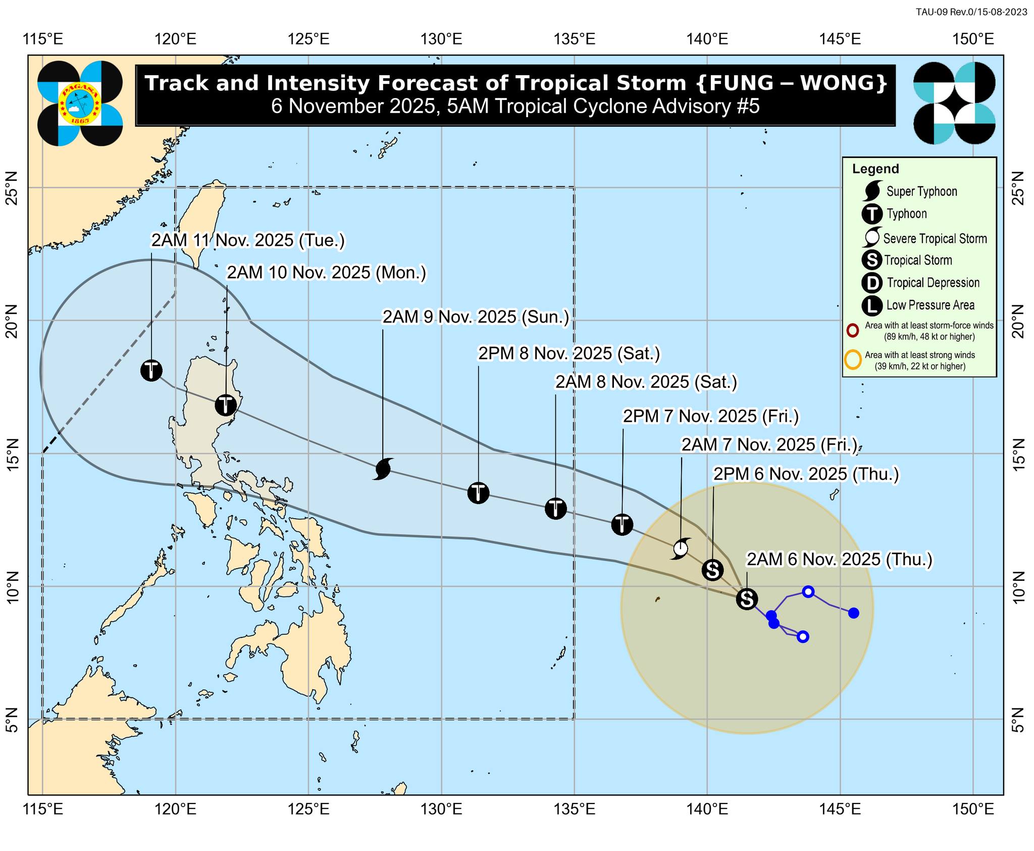
Tropical Storm Fung-Wong had maximum sustained winds of 65 km/h near the center and gusts of up to 80 km/h as of 4 a.m. It was last spotted 1,715 km east of Northeastern Mindanao, moving northwestward at 20 km/h.
Fung-Wong will be given the local name Uwan once it enters the PAR late Friday evening or early Saturday morning.
PAGASA said Fung-Wong may reach typhoon category on Friday and super typhoon status on Saturday.
"Although the uncertainty in track and intensity forecasts is typically high for day-4 and day-5 forecasts, there is an increasing chance of landfall on Monday (November 10) over Northern or Central Luzon."
Wind signals may be raised over the eastern portion of Luzon and portions of Samar provinces as early as Friday evening or Saturday morning, but weather conditions may only begin to deteriorate on Sunday.
"The highest possible Wind Signal for the current forecast scenario is Wind Signal No. 5," PAGASA said.
"Potentially life-threatening stormy conditions may occur over Northern Luzon and portions of Central Luzon on Monday (November 10) and Tuesday (November 11). There is also a potential for high storm surge risk and related coastal flooding, especially in Northern Luzon and the east coast of Central Luzon. Storm surge warnings may be issued as early as Saturday." —VBL, GMA Integrated News
