

Signal No. 1 still up in Kalayaan Islands as Tino moves closer to Vietnam

Signal No. 1 remains hoisted over the Kalayaan Islands as Typhoon Timo intensified outside the Philippine Area of Responsibility (PAR).
According to PAGASA’s 11 p.m. cyclone bulletin, Tino was last located at 355 kilometers northwest of Pag-asa Islands, Kalayaan, Palawan and outside the PAR as of 10 a.m.
Tino was packing maximum sustained winds of 165 kph and gustiness of up to 205 kph.
The Kalayaan Islands will be experiencing strong winds of 39 to 61 kph in at least 36 hours under Signal No. 1.
Meanwhile, up to rough seas may be expected in some coastal areas in Kalayaan Islands, Batanes, Palawan, and Balabac Island.
PAGASA warns the public of possible hazards that may still occur outside the forecast confidence cone as Tino continues to move and may make landfall in Central Vietnam by Thursday night.
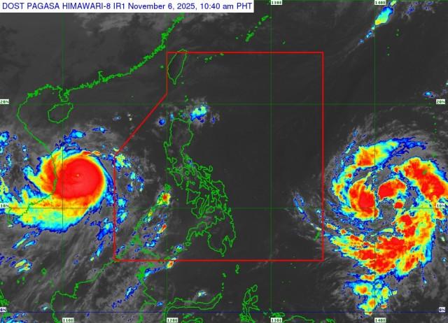
Tropical Storm Fung-Wong
PAGASA is also monitoring Tropical Storm Fung-Wong, currently at 1,690 kilometers east of Northeastern Mindanao outside the PAR.
As of 10 a.m., PAGASA said that the typhoon had maximum sustained winds of 75 kph and gustiness of up to 90 kph.
The typhoon currently has no effect or has caused any wind signals in the country, but PAGASA earlier noted that it might cause impacts as strong as Signal no. 5.
Fung-Wong may enter the PAR by Friday late evening or early Saturday morning and will be locally called Uwan.
The cyclone is expected to intensify into a super typhoon by Saturday and make landfall in Northern or Central Luzon by Monday at or near peak lifetime intensity.
PAGASA warns the public of high-risk storm surges and rough sea conditions as a result of said weather conditions.
— RSJ/ VAL, GMA Integrated News
