

Uwan maintains strength outside PAR; Signal No. 2 raised over 10 areas
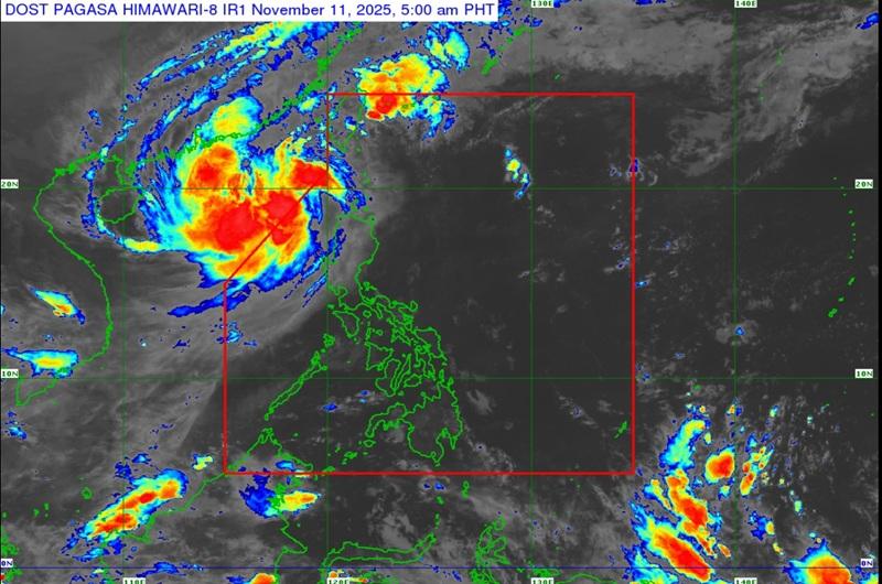
Typhoon Uwan maintains its strength, moving northward outside the Philippine Area of Responsibility (PAR) as Signal No. 2 remains over 10 areas, according to the Tropical Cyclone Bulletin posted by PAGASA early Tuesday morning.
The center of Typhoon Uwan was estimated based on all available data at 365 km West of Calayan, Cagayan outside PAR packing maximum sustained winds of 120 kilometers per hour near the center, gustiness of up to 150 km/h and moving northward at 15 km/h.
Tropical Cyclone Wind Signal (TCWS) No. 2 is hoisted over the following areas:
- Batanes
- Cagayan including Babuyan Islands
- Apayao
- Abra
- Kalinga
- the western portion of Mountain Province (Besao, Tadian, Sagada, Bauko, Sadanga, Bontoc, Sabangan, Barlig)
- the northwestern portion of Benguet (Mankayan, Kapangan, Kibungan, Bakun)
- Ilocos Norte
- Ilocos Sur
- the northern portion of La Union (Luna, Santol, City of San Fernando, San Juan, Bagulin, Bangar, San Gabriel, Bacnotan, Sudipen, Balaoan)
TCWS No. 1 is hoisted over the following areas:
- Isabela
- Quirino
- Nueva Vizcaya
- the rest of Benguet
- Ifugao
- the rest of Mountain Province
- the rest of La Union
- Pangasinan
- Aurora
- Nueva Ecija
- Zambales
- Bataan
- Tarlac
- Pampanga
- Bulacan
- Metro Manila
- Cavite
- Laguna
- the northern and western portions of Batangas (Tuy, Nasugbu, Lian, Calatagan, Balayan, Calaca, Laurel, Talisay, Lemery, Agoncillo, San Nicolas, City of Tanauan, Santo Tomas)
- Rizal
- the northern portion of Quezon (General Nakar, Infanta, Real) including Polillo Islands, and Lubang Islands
Rainfall outlook
Heavy rainfall outlook due to Uwan (50-100 mm) over Ilocos Norte, Ilocos Sur, La Union, Benguet, and Abra.
"Forecast rainfall may be higher in mountainous and elevated areas. Moreover, impacts in some areas may be worsened by significant antecedent rainfall," PAGASA reported.
Outside the areas under Wind Signals, Uwan will also bring occasionally gusty conditions reaching strong to gale-force strength over the following areas (especially in coastal and upland areas exposed to winds): Most of Luzon, Western Visayas, Negros Island Region, and Northern Samar.
The weather bureau added that a Gale Warning is in effect over the seaboards of Northern Luzon and the western seaboards of Central Luzon and Southern Luzon.
Uwan is outside the PAR and will follow a recurving path turning northward then northeastward for most of the forecast period and may re-enter PAR on Wednesday evening as it makes landfall over the southwestern coast of Taiwan.
PAGASA said that Uwan will then emerge over the waters near Ryukyu Islands on Thursday, where it is expected to eventually weaken into a remnant low on Friday. — BAP, GMA Integrated News
