

3 Luzon areas under Signal No. 1 as Uwan approaches Taiwan
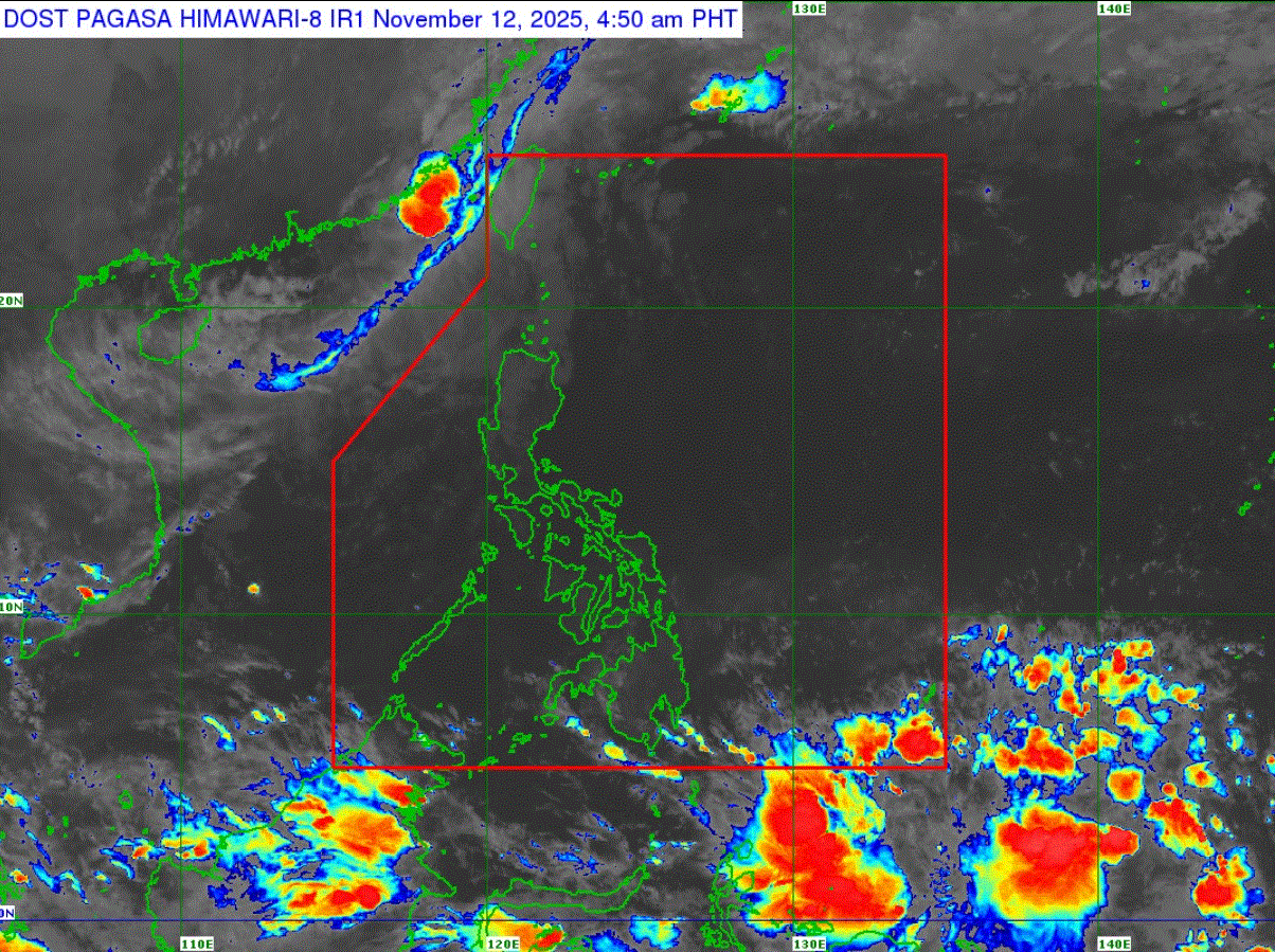
Severe Tropical Storm Uwan maintained its strength as it slowly moved over the seas South of Taiwan, PAGASA said on Wednesday.
According to its 5 a.m. cyclone bulletin, the center of Uwan was estimated at 280 km West of Itbayat, Batanes, outside the Philippine Area of Responsibility (PAR).
It is moving north northeastward at 10 kilometers per hour with maximum sustained winds of 95 km/h near the center and gustiness of up to 115 km/h.
Three areas in Luzon remain under Signal No. 1:
- Batanes
- Babuyan Islands (Calayan Is., Dalupiri Is., Fuga Is.)
- the northwestern portion of Ilocos Norte (Burgos, Bangui, Pasuquin, Dumalneg, Pagudpud)
"Minimal to minor impacts from strong winds are possible within any of the areas under Wind Signal No. 1," PAGASA said.
Uwan is forecast to move generally northeastward, re-entering PAR Wednesday morning or afternoon before making landfall over the southwestern coast of Taiwan by afternoon or evening, according to the weather bureau.
"It will then emerge over the eastern coastal waters of Taiwan towards Ryukyu Islands from tomorrow (13 November) until Friday (14 November)," it said.
"Uwan is expected to weaken into a tropical storm before its landfall over the southwestern coast of Taiwan. After landfall, its interaction with the landmass of Taiwan as well as unfavorable environmental conditions will trigger a continuous weakening trend until it weakens into a remnant low by Friday," PAGASA added. —LDF, GMA Integrated News
