

LPA east of Mindanao enters PAR
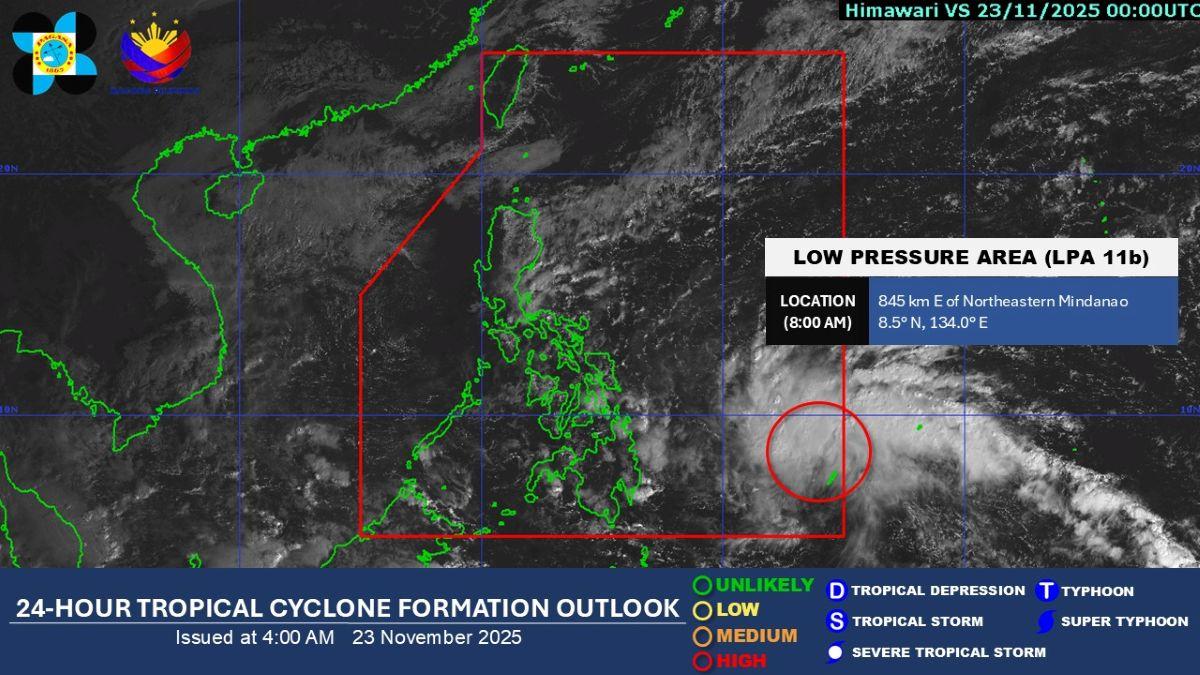
A low pressure area (LPA) located east of Mindanao entered the Philippine Area of Responsibility (PAR) on Sunday morning, PAGASA said.
The LPA (LPA 11b) was monitored inside PAR at 8 a.m.
PAGASA said the LPA "now has a 'HIGH' chance to develop into a tropical depression within the next 24 hours."
If it does, it will be renamed Verbena.
At 8 a.m., the LPA was estimated to be located at 845 km east of Northeastern Mindanao.
"Posibleng maapektuhan nito ang malaking bahagi ng Visayas and Southern Luzon (It may possibly affect a big part of Visayas and Southern Luzon), PAGASA weather specialist Obet Badrina said during the bureau's 5 a.m. public weather forecast.
On Sunday, the trough or extension of the LPA is already affecting Northern Mindanao, Caraga, Davao Region, Eastern Visayas, and Bohol. These areas will have cloudy skies with scattered rains and thunderstorms. Residents are warned against possible flash floods or landslides due to moderate to at times heavy rains.
In its heavy rainfall outlook, PAGASA said 50 to 100 mm of rainfall due to the LPA may be expected on Monday in:
- Northern Samar;
- Samar;
- Eastern Samar;
- Leyte;
- Biliran;
- Southern Leyte;
- Cebu;
- Bohol;
- Siquijor;
- Dinagat Islands;
- Surigao del Norte;
- Surigao del Sur;
- Agusan del Norte;
- Misamis Oriental; and
- Camiguin.
On Tuesday, November 25, about 100 to 200 mm of rainfall may be felt in Northern Samar and Eastern Samar
Moderate to heavy rains measuring 50-100 mm meanwhile may be expected on Tuesday in Camarines Sur, Camarines Norte, Catanduanes, Albay, Sorsogon, Masbate, Oriental Mindoro, Marinduque, Romblon, Antique, Aklan, Capiz, Iloilo, Guimaras, Negros Occidental, Negros Oriental, Cebu, Bohol, Samar, Biliran, Leyte, Southern Leyte, Dinagat Islands, and Surigao del Norte. —KG, GMA Integrated News
