

LPA inside PAR has ‘high’ chance of becoming storm — PAGASA
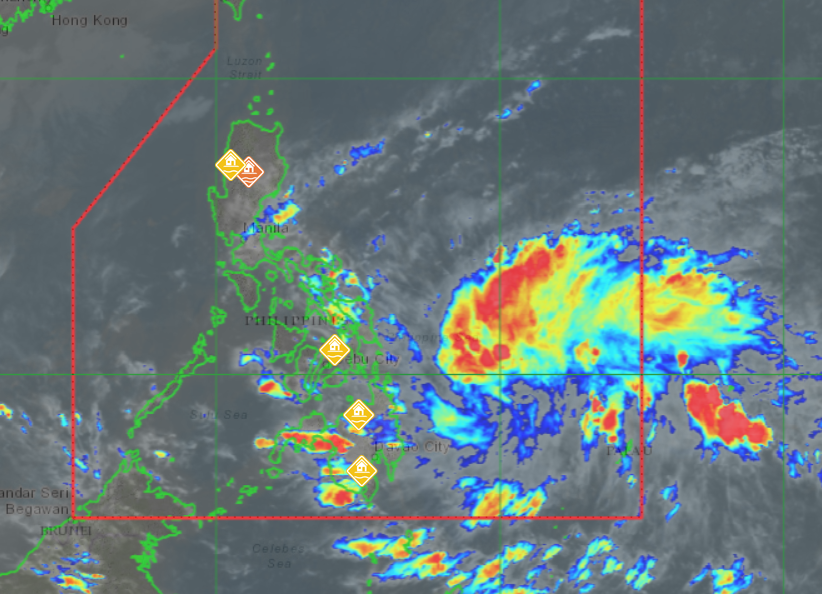
The low-pressure area (LPA) inside the Philippine Area of Responsibility (PAR) has a “high” chance of developing into a tropical depression within the next 24 hours, PAGASA said Sunday afternoon.
As of 3 p.m., the LPA was located 715 kilometers east of Hinatuan, Surigao del Sur.
Its trough will affect weather conditions in Visayas, Northern Mindanao, Caraga, Davao Region, the rest of Bicol Region, and the Zamboanga Peninsula, according to PAGASA’s 4 p.m. forecast.
Meanwhile, the shear line will bring cloudy skies with scattered rain showers and isolated thunderstorms in Metro Manila, CALABARZON, Aurora, Apayao, Kalinga, Mountain Province, Ifugao, Cagayan, Isabela, Quirino, Camarines Norte, and Camarines Sur.
Cloudy skies with rain will persist over the rest of the Cordillera Administrative Region, the remaining parts of Cagayan Valley, and Central Luzon due to the Northeast Monsoon (Amihan), which will also affect the Ilocos Region.
MIMAROPA and the rest of Mindanao are expected to experience partly cloudy to cloudy skies with isolated rain showers or thunderstorms from localized activity.
State meteorologists warned of strong winds and rough coastal waters in Northern Luzon and the eastern sections of Visayas, Central Luzon, and Southern Luzon.
Moderate to strong winds and moderate coastal waters are expected over the rest of Luzon and Visayas, while Mindanao will see light to moderate winds and slight to moderate coastal waters.
Sunrise in Metro Manila is expected at 6:01 a.m. on Monday.—MCG, GMA Integrated News
