

More areas under Signal No. 1 as Verbena set to make landfall
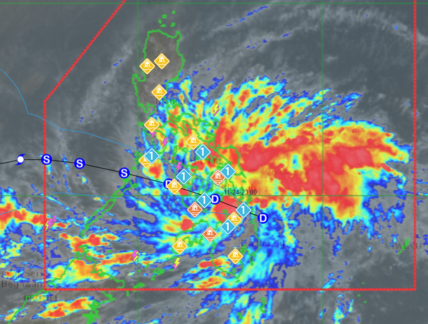
Signal No. 1 has been raised in more areas as Tropical Depression Verbena is about to make landfall over Surigao del Sur, PAGASA said Monday afternoon.
At 1 p.m., Verbena was located over the coastal waters of Bayabas, Surigao del Sur, with maximum sustained winds of 45 km/h near the center and gusts of up to 55 km/h. It was moving westward at 25 km/h.
Based on the state weather bureau’s 2 p.m. cyclone bulletin, the following areas are under Signal No. 1:
Luzon
- Occidental Mindoro
- Oriental Mindoro
- Romblon
- The northern portion of Palawan (Araceli, Taytay, El Nido, Dumaran, Roxas, San Vicente), including Calamian, Cuyo, and Cagayancillo Islands
- Mainland Masbate (Balud, Mandaon, Milagros, Cawayan, Placer, Pio V. Corpuz, Esperanza, Uson, City of Masbate, Mobo, Palanas, Aroroy, Cataingan, Baleno)
Visayas
- Antique
- Aklan
- Capiz
- Iloilo
- Guimaras
- Negros Occidental
- Negros Oriental
- Siquijor
- Cebu
- Bohol
- Samar
- Eastern Samar
- Biliran
- Leyte
- Southern Leyte
Mindanao
- Dinagat Islands
- Surigao del Norte
- Surigao del Sur
- Agusan del Norte
- Agusan del Sur
- Camiguin
- Misamis Oriental
- The northern portion of Bukidnon (Baungon, Libona, Manolo Fortich, Sumilao, Impasug-ong, City of Malaybalay, Malitbog, Cabanglasan)
PAGASA warned that areas under Signal No. 1 may experience minimal to minor impacts from strong winds.
It added that on Monday, the surge of the Northeast Monsoon (Amihan) combined with the storm will bring gusty conditions reaching strong to gale-force strength over Luzon, Visayas, Surigao del Sur, Misamis Oriental, Misamis Occidental, and Zamboanga del Norte—even in areas not under any wind signal.
A gale warning is also in effect over the northern seaboard of Northern Luzon.
“It must be emphasized that heavy rainfall, severe winds, and storm surge may still be experienced in localities outside the landfall point and outside the forecast confidence cone,” PAGASA said.
“Furthermore, the track may still shift within the limit of the forecast confidence cone,” it added.
Verbena is expected to move generally west-northwest throughout its passage across the central portion of the country between Monday and Tuesday.
It is forecast to make landfall over the Caraga Region on Monday afternoon, then accelerate across Visayas and the northern portion of Palawan between Monday evening until Tuesday evening before emerging over the West Philippine Sea on Wednesday morning.
The storm is expected to exit the Philippine Area of Responsibility on Thursday.
“Verbena may slightly intensify prior to landfall but will likely cross Visayas as a tropical depression. It may reach tropical storm category either before reaching northern Palawan or once over the West Philippine Sea,” PAGASA said.
“Verbena may peak at severe tropical storm category in the middle of the West Philippine Sea,” it added.—MCG, GMA Integrated News
