

PAGASA: 30 areas still under signal No. 1 as Verbena slightly speeds up
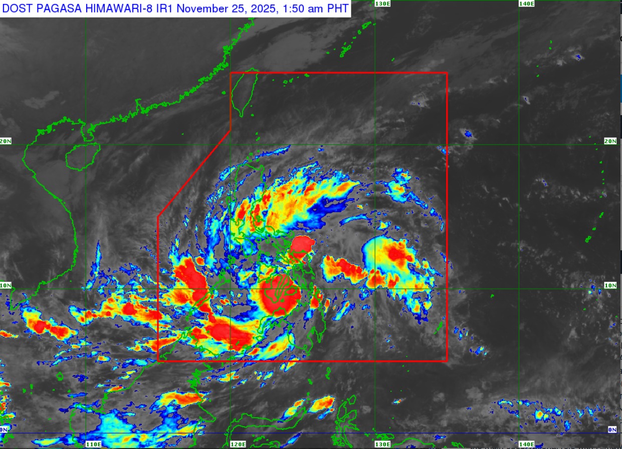
Thirty areas remained under Tropical Cyclone Signal No. 1 as Tropical Depression Verbena slightly accelerated and is now in the vicinity of Inabanga, Bohol, the state weather bureau said on Tuesday morning.
In its 2 a.m. tropical cyclone bulletin, PAGASA said Signal No. 1 is in effect over the following areas:
Luzon:
- Occidental Mindoro,
- Oriental Mindoro,
- Romblon,
- The northern and central portions of Palawan (Araceli, Taytay, El Nido, Dumaran, Roxas, San Vicente, Puerto Princesa City) including Calamian, Cuyo, and Cagayancillo Islands, and
- Mainland Masbate (Balud, Mandaon, Milagros, Cawayan, Placer, Pio V. Corpuz, Esperanza, Uson, Dimasalang, City of Masbate, Mobo, Palanas, Aroroy, Cataingan, Baleno).
Visayas:
- Antique,
- Aklan,
- Capiz,
- Iloilo,
- Guimaras,
- Negros Occidental,
- Negros Oriental,
- Siquijor,
- Cebu,
- Bohol,
- Samar,
- Eastern Samar,
- Biliran,
- Leyte, and
- Southern Leyte.
Mindanao:
- Dinagat Islands,
- Surigao del Norte,
- Surigao del Sur,
- Agusan del Norte,
- Agusan del Sur,
- Camiguin,
- Misamis Oriental,
- The northern portion of Bukidnon (Baungon, Libona, Manolo Fortich, Sumilao, Impasug-Ong, City of Malaybalay, Malitbog, Cabanglasan),
- The northern portion of Misamis Occidental (Sapang Dalaga, Calamba, Baliangao, Plaridel, Lopez Jaena, Oroquieta City, Aloran, Panaon, Jimenez, Concepcion), and
- The northern portion of Zamboanga del Norte (Jose Dalman, Manukan, Pres. Manuel A. Roxas, Katipunan, Dipolog City, Polanco, Piñan, Dapitan City, La Libertad, Sibutad, Rizal, Mutia).
As of 1 a.m., the center of Verbena was estimated to be in the vicinity of Inabanga,Bohol with maximum sustained winds of 55 km/h near the center, gustiness of up to 90 km/h, and central pressure of 998 hPa.
The tropical depression continues to move west northwestward at 25 km/h.
PAGASA said Verbena made landfall over Jagna, Bohol at 11:10 p.m. Monday.
The tropical depression is forecast to continue moving west northwestward across Visayas and the northern portion of Palawan on Tuesday before emerging over the West Philippine Sea by Wednesday morning.
Verbena is expected to turn westward and pass north of Kalayaan Islands and exit the Philippine Area of Responsibility on Thursday midnight or early morning.
The state weather bureau said Verbena will likely cross Visayas as a tropical depression and “may reach tropical storm category either before reaching northern Palawan or once over the West Philippine Sea.”
“Verbena may peak at severe tropical storm category while in the middle of the West Philippine Sea north of Kalayaan Islands,” it added. — JMA, GMA Integrated News
