

Verbena heads for WPS, Signal No. 2 remains over Palawan's northern portion
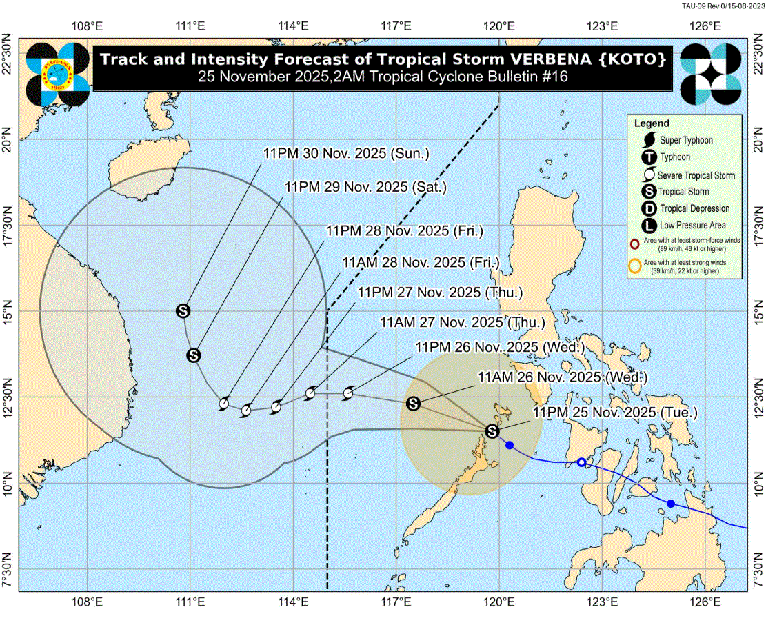
Signal No. 2 remains hoisted over the extreme portion of mainland Palawan due to Tropical Storm Verbena, which is moving west northwestward over the West Philippine Sea, according to PAGASA.
In its 2 a.m. tropical cyclone bulletin, the weather bureau issued a heavy rainfall outlook due to the tropical storm and the shear line.
Calamian Islands and extreme northern portion of mainland Palawan (El Nido, Taytay, Araceli) are still under Signal No. 2.
Meanwhile, areas under Signal No. 1 are Occidental Mindoro, Oriental Mindoro, the southern portion of Romblon (Santa Fe, Ferrol, Looc, San Jose), and the northern and central portions of Palawan (Dumaran, Roxas, San Vicente, Puerto Princesa City) including Cuyo and Cagayancillo Islands, which are all in Luzon.
Visayas areas under Signal No. 1 are Antique and the northwestern portion of Aklan (Malay, Buruanga, Nabas).
At 10:50 p.m. Tuesday, Verbena made landfall over Linapacan, Palawan. It will then continue moving west northwestward over the West Philippine Sea on Wednesday morning before moving westward and passing north of Kalayaan Islands in the evening.
PAGASA said the cyclone will then exit the Philippine Area of Responsibility Thursday morning, and turn west southwestward from Thursday until Friday morning.
Verbena may reach severe tropical storm category Wednesday afternoon or evening and will continue to intensify until Thursday due to favorable environment. Afterwards, a weakening trend may occur due to the effect of the surge of the Northeast Monsoon, the weather bureau added.
The center Verbena was estimated over the coastal waters of Linapacan, Palawan. It is moving northwestward at 25 kilometers per hour with maximum sustained winds of 75 km/h near the center and gustiness of up to 105 km/h. —LDF, GMA Integrated News
