

LPA outside PAR has 'high' chance of developing into cyclone
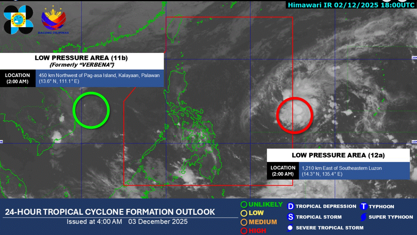
Another cyclone might hit the country before the year ends, as weather bureau PAGASA predicts the low pressure area (PAR) it is monitoring outside the Philippine Area of Responsibility (PAR) may become a tropical depression.
"The LPA being monitored outside PAR has a high potential of developing into a tropical depression within the next 24 hours," PAGASA said in its 4 a.m. daily weather bulletin.
Once it enters PAR, it will be named Wilma, weather specialist Loriedin De La Cruz-Galicia said. Landfall is likely over Eastern Visayas or Caraga.
Meanwhile, as of 2 a.m. Wednesday, Tropical Depression Koto (formerly Verbena) has weakened into an LPA while still being monitored outside PAR.
Basilan, Sulu, and Tawi-Tawi will have cloudy skies with scattered rains and thunderstorms due to the Intertropical Convergence Zone (ITCZ).
Cagayan Valley, Ilocos Norte, Apayao, Kalinga, and Aurora will see cloudy skies with rains as a result of the Northeast Monsoon.
The rest of Ilocos Region, the rest of Cordillera Administrative Region, and the rest of Central Luzon will experience partly cloudy to cloudy skies with isolated light rains also as effects of the Northeast Monsoon,
Metro Manila and the rest of the country will have partly cloudy to cloudy skies with isolated rainshowers or thunderstorms due to the localized thunderstorms.
Sunrise is at 6:06 a.m. and sunset is at 5:25 p.m. —LDF, GMA Integrated News
