

LPA enters PAR, has ‘high’ chance of becoming tropical depression — PAGASA
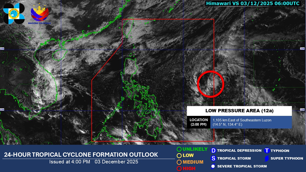
A low pressure area (LPA) entered the Philippine area of responsibility Wednesday afternoon and has a “high” chance of developing into a tropical depression within the next 24 hours, the state weather bureau PAGASA said.
As of 2 p.m., the LPA was monitored 1,105 kilometers east of southeastern Luzon.
On the other hand, the LPA formerly known as “Verbena”, which peaked into a typhoon, has exited the monitoring domain of PAGASA. It has battered parts of the Visayas island with over 200,000 individuals affected.
Meanwhile, based on PAGASA's 24-hour weather forecast issued at 4 p.m., the intertropical convergence zone (ITCZ) and the northeast monsoon, or Amihan, will affect parts of the country.
The ITCZ will bring cloudy skies with scattered rains and thunderstorms over Basilan, Sulu, and Tawi-Tawi.
The Amihan, on the other hand, is expected to bring cloudy skies with rains over Cagayan Valley and the Cordillera Administrative Region. It is also forecast to bring partly cloudy to cloudy skies with isolated light rains over Ilocos Region and the rest of Central Luzon.
Further, residents in Aurora, Quezon, and Camarines Norte may experience cloudy skies with scattered rains and isolated thunderstorms due to the shear line.
The localized thunderstorms may also cause partly cloudy to cloudy skies with isolated rainshowers and thunderstorms over Metro Manila and the rest of the country. —Vince Angelo Ferreras/AOL, GMA Integrated News
