

TD Wilma speeds up, moves over Calbayog City
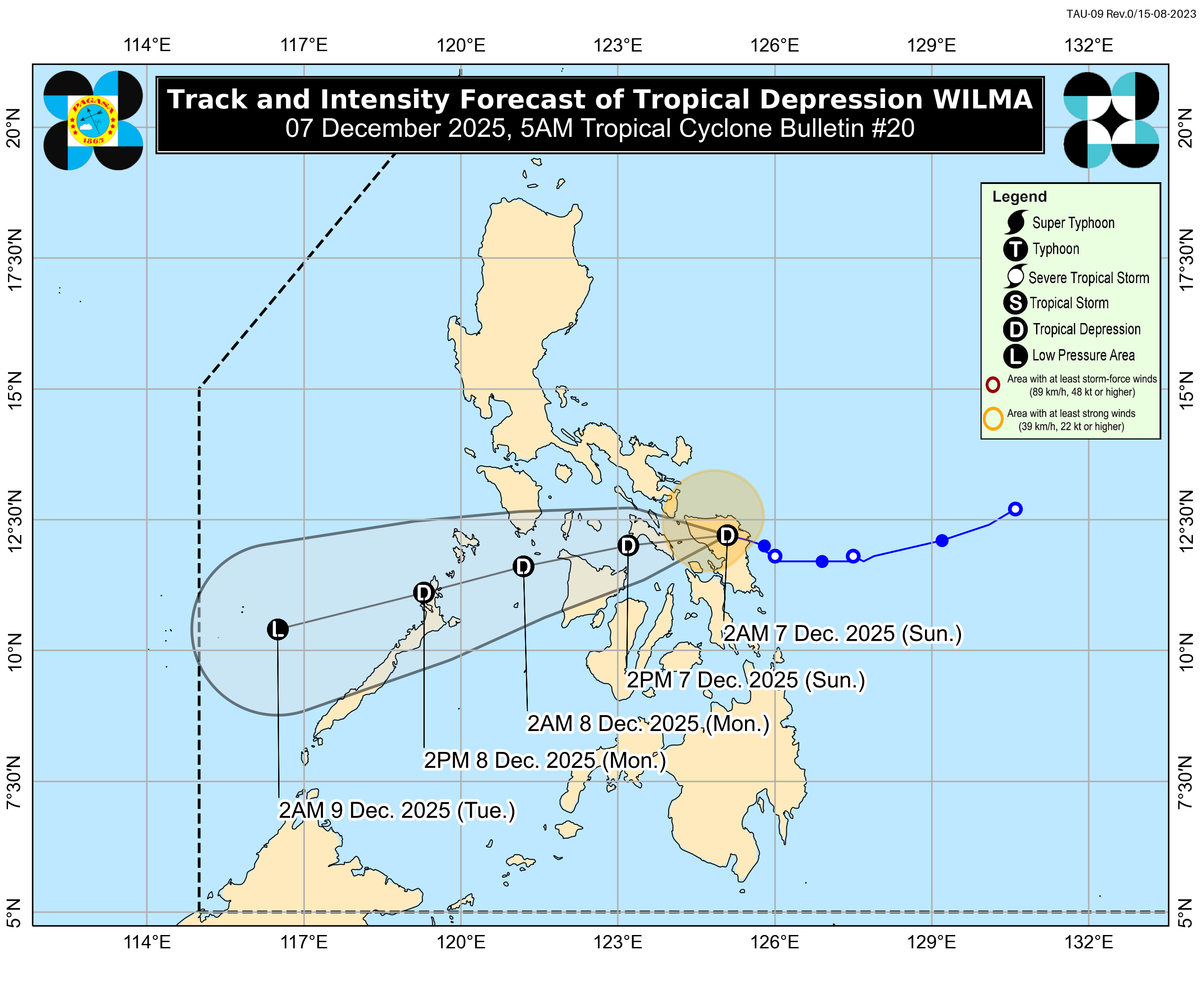
Tropical Depression Wilma has accelerated slightly as it crossed Samar on Sunday morning, with its center now located over Calbayog City, according to the state weather bureau.
PAGASA said Wilma is moving west-southwest at 15 km/h and is expected to traverse Southern Luzon and the Visayas throughout the day before emerging over the Sulu Sea. It may pass over northern Palawan by Monday morning or afternoon.
The weather bureau maintained that Wilma will likely remain a tropical depression during its inland passage, though the surge of the northeast monsoon makes an earlier weakening into a low-pressure area possible.
PAGASA said Tropical Cyclone Wind Signal No. 1 remains in effect over several areas, where minimal to minor impacts from strong winds are possible. Local winds may be more intense in coastal and upland communities exposed to the prevailing wind direction, while sheltered areas may feel weaker gusts.
Nakataas pa rin ang Tropical Cyclone Wind Signal No. 1 sa ilang lugar sa bansa dahil sa Bagyong #WilmaPH, base sa 5 AM bulletin ng PAGASA ngayong Dec. 7, 2025. pic.twitter.com/hnFcHoh4uP
— GMA Integrated News (@gmanews) December 6, 2025
Even outside signal-covered provinces, the Northeast Monsoon (Amihan) is expected to deliver strong to gale-force gusts over wide areas and will affect most of Luzon, the Visayas, and the Zamboanga Peninsula today; most of Luzon again on Monday and on Tuesday.
PAGASA reminded the public that rainfall and wind hazards may extend beyond the cyclone’s center and even outside the forecast track cone and the prevailing shear line. —MCG/KG, GMA Integrated News
