

LPA outside PAR ‘unlikely’ to become storm — PAGASA
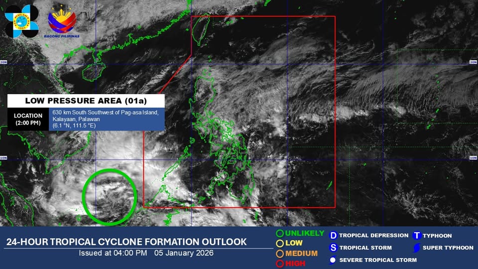
The low pressure area (LPA) monitored outside the Philippine Area of Responsibility is “unlikely” to develop into a tropical depression within the next 24 hours, PAGASA said Monday afternoon.
For now, the LPA’s trough will affect the weather conditions of Zamboanga Peninsula, Basilan, Tawi-Tawi, and Palawan, according to the state weather bureau’s 4 p.m. weather forecast.
Meanwhile, cloudy skies with scattered rains and isolated thunderstorms will persist in the Bicol Region, Quezon, Oriental Mindoro, Marinduque, Romblon, Northern Samar, Antique, Aklan, Capiz, and Iloilo due to the shear line.
The rest of Visayas and Caraga will experience cloudy skies with scattered rains and thunderstorms due to the easterlies.
The easterlies will also bring partly cloudy to cloudy skies with isolated rain showers or thunderstorms throughout the rest of Mindanao.
PAGASA warned that these weather conditions may trigger flash floods and landslides.
Meanwhile, the Northeast Monsoon (Amihan) will affect the weather conditions of the Cordillera Administrative Region, Cagayan Valley, Aurora, Metro Manila, and the rest of Luzon, with no significant impact.
State meteorologists also said winds will be moderate to strong, while coastal waters will be moderate to rough in Luzon and the eastern sections of Visayas and Mindanao.
The rest of the country will experience light to moderate wind conditions and slight to moderate coastal water conditions.
Sunrise in Metro Manila will be at 6:23 a.m. on Tuesday. — Mariel Celine Serquiña/RF, GMA Integrated News
