

PAGASA: LPA outside PAR; 4 weather systems to bring rains
The state weather bureau on Tuesday said it is monitoring a low-pressure area (LPA 01b) located outside the Philippine Area of Responsibility (PAR), which has a medium chance of developing into a tropical depression within the next 24 hours.
In an advisory issued at 8:00 a.m., PAGASA said the weather disturbance remains outside PAR but could still influence prevailing weather conditions should it continue to intensify.
The public is advised to regularly monitor official updates from the agency.
Meanwhile, PAGASA said four weather systems are expected to bring cloudy skies and rains over various parts of the country on Tuesday.
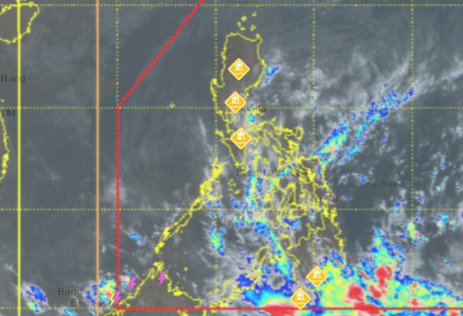
These include the shear line, northeast monsoon (amihan), Intertropical Convergence Zone (ITCZ), and the easterlies.
In its 4:00 a.m. daily weather forecast, PAGASA said the shear line is affecting the eastern section of Northern Luzon, while the northeast monsoon continues to affect the rest of Northern Luzon, bringing cloudy skies with rains and isolated thunderstorms.
The ITCZ is expected to bring cloudy skies with scattered rains and thunderstorms over parts of Mindanao, while the easterlies will affect the rest of the country, resulting in generally cloudy skies with isolated rain showers or thunderstorms.
PAGASA warned that moderate to at times heavy rains associated with these weather systems may trigger flash floods or landslides, especially in vulnerable and mountainous areas.
Residents were advised to take the necessary precautions and stay informed through official PAGASA bulletins and advisories.—MCG, GMA Integrated News
