

Ada speeds up slightly as it moves away from PH
Tropical Depression Ada slightly sped up as it crossed the Philippine Sea east of Luzon and continued to move away from the Philippine landmass, the state weather bureau said late Monday night.
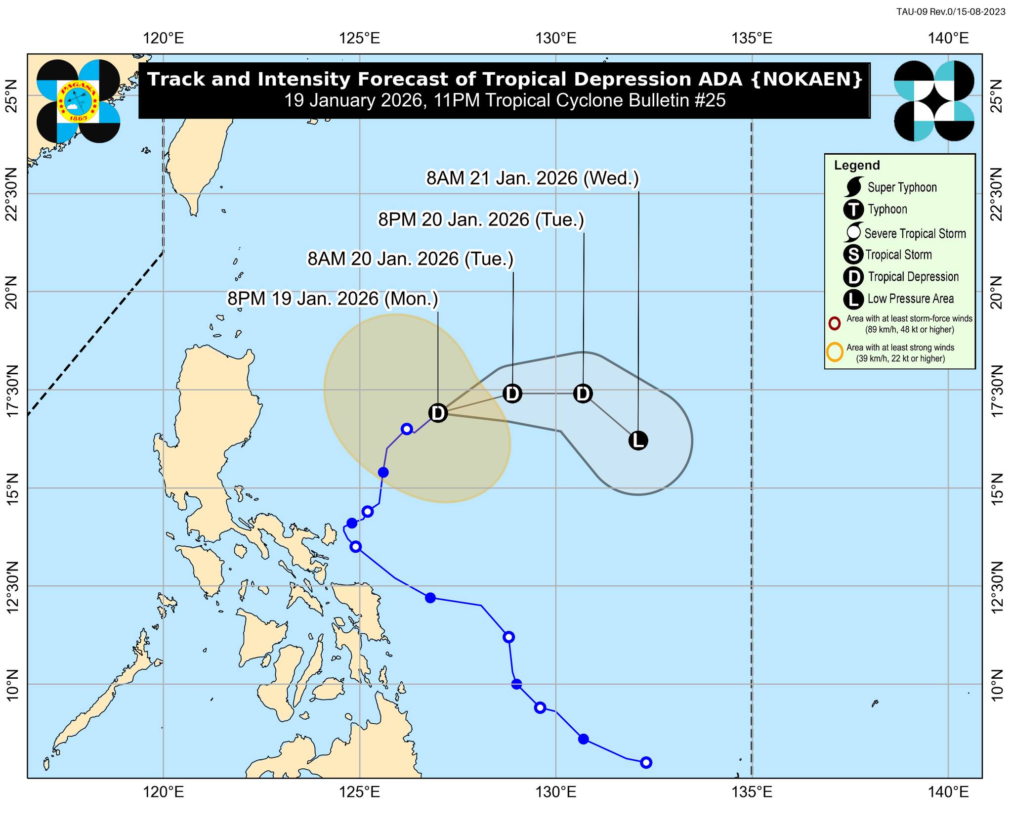
In its 11 p.m. tropical cyclone bulletin, PAGASA said the center of Ada was estimated to be 570 km east of Casiguran, Aurora as of 10 p.m. Monday and slightly accelerated while over the Philippine Sea.
It has maximum sustained winds of 55 km/h near the center, gustiness of up to 70 km/h, and central pressure of 1000 hPa and is moving northeastward at 15 km/h.
Similar to previous tropical cyclone updates since Sunday night, no wind signals are in effect as Ada moved away from the landmass.
However, the state weather bureau warned of strong winds that extend outwards up to 340 km from the center of the tropical depression.
Ada is forecast to move generally east northeastward before turning eastward to southeastward from Tuesday until Wednesday.
“Continuous dry air entrainment from the northeast monsoon is expected to result in gradual weakening of Ada,” PAGASA said, adding that it may be downgraded into a low pressure area (LPA) by Wednesday or even earlier.
Despite the absence of wind signals, the state weather bureau said the surge of the Northeast Monsoon will bring strong to gale-force gusts over Batanes, Babuyan Islands, northern and eastern mainland Cagayan, eastern Isabela, Ilocos Norte, Ilocos Sur, Abra, Aurora, CALABARZON, Oriental Mindoro, Occidental Mindoro, Romblon, Marinduque, Bicol Region, Northern Samar, Samar, Eastern Samar, and Dinagat Islands on Tuesday.
The surge of the Amihan is also expected to cause strong to gale-force gusts in the Ilocos Region, Abra, Apayao, Cagayan Valley, Aurora, Bulacan, Bataan, Metro Manila, CALABARZON, MIMAROPA, Bicol Region, Visayas, Caraga, Davao Region, Camiguin, Misamis Oriental, Lanao del Norte, Zamboanga Peninsula, Basilan, and Tawi-Tawi on Wednesday. — JMA, GMA Integrated News
