

LPA with high chance of becoming tropical depression moving closer to PAR
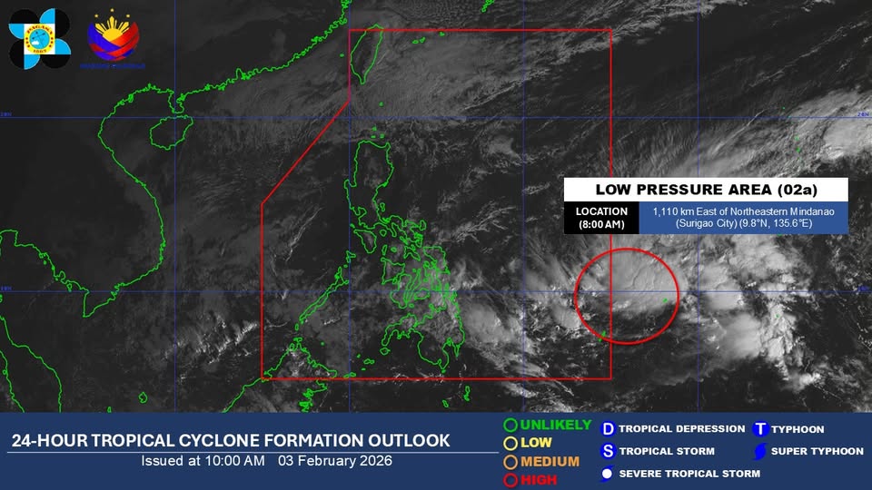
A low pressure area being monitored outside the Philippine Area of Responsibility (PAR) and has a high chance of developing into a tropical depression within the next 24 hours is moving closer to the country.
According to PAGASA’s advisory, the LPA was last seen at 1,110 kilometers east of Northeastern Mindanao (Surigao City) as of 8 a.m., Tuesday. It was spotted 1,370 kilometers east of Northeastern Mindanao as of 2 a.m.
As of 4 a.m., PAGASA said that the shear line and the Northeast Monsoon will cause rains across the country.
Possible flash floods or landslides may occur in some areas as a result of said weather conditions, while varied wind and water conditions are to be expected nationwide.
Earlier, PAGASA reported that 4 to 11 tropical cyclones may be expected in the country from February to June 2026.
The Philippines already had one tropical storm, Ada, in January 2026. —Jiselle Anne C. Casucian/AOL, GMA Integrated News
