

LPA east of Mindanao develops into tropical depression
A tropical depression has formed outside the Philippine Area of Responsibility (PAR) as the Northeast Monsoon (Amihan) affects several areas of the country.
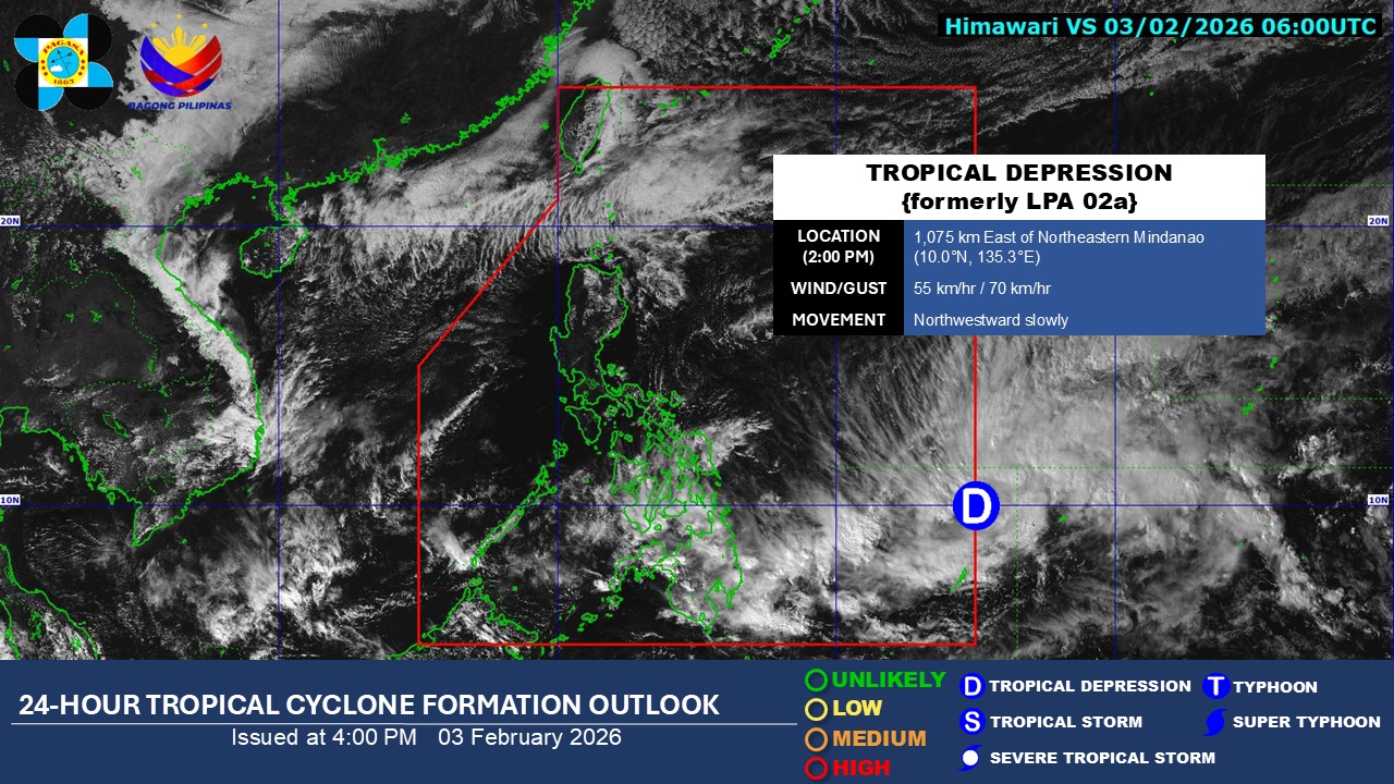
According to PAGASA’s daily weather forecast on Tuesday afternoon, the tropical depression was located 1,075 kilometers east of Northeastern Mindanao as of 3 p.m.
It currently has maximum sustained winds of 55 km/h and gustiness of up to 70 km/h.
Once it enters the country, the cyclone will be called “Basyang."
Eastern Visayas, Central Visayas, Negros Islands Region, Caraga, Davao Region, Northern Mindanao, and Zamboanga Peninsula will experience cloudy skies with scattered rains and thunderstorms caused by the trough of the tropical depression.
The Northeast Monsoon will bring cloudy skies with rains over the Batanes and Babuyan Islands and partly cloudy to cloudy skies with isolated light rains over Metro Manila and the rest of Luzon.
The rest of the country will have partly cloudy to cloudy skies with isolated rain showers or thunderstorms caused by localized thunderstorms.
Flash floods or landslides may occur due to these weather systems.
Meanwhile, moderate to strong winds with moderate to rough seas will be felt in Northern Luzon, the eastern sections of Central and Southern Luzon, Visayas, and Mindanao, while the rest of the country will experience light to moderate winds with slight to moderate coastal waters.
Sunrise in Metro Manila will be at 6:24 a.m. on Wednesday. —Jiselle Anne Casucian/VBL, GMA Integrated News
