

Tropical Depression Basyang to gradually intensify over PH sea
Tropical Depression Basyang continues to linger in the Philippines Area of Responsibility and is expected to gradually intensify as it moves westward, weather bureau PAGASA said.
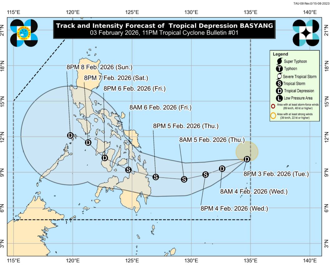
No wind signal has yet been hoisted based on PAGASA's 11 p.m. cyclone bulletin, although Signal No. 1 is seen to be raised over Caraga early Wednesday.
The highest wind signal that may be hoisted throughout its passage is Wind Signal No. 2.
"Basyang is forecast to gradually intensify while over the Philippine Sea and may reach tropical storm category by tomorrow (Wednesday). It will then gradually weaken into a tropical depression by Friday due to land interaction," PAGASA said.
The center of Basyang was estimated at 965 kilometers East of Northeastern Mindanao. It is moving westward at 10 km/h with maximum sustained winds of 55 kkm/h near the center and gustiness of up to 70 km/h.
"It must be emphasized that heavy rainfall and severe winds may still be experienced in localities outside the landfall point and the forecast confidence cone," PAGASA said.
According to the weather bureau, Basyang will move generally west southwestward until Thursday before moving westward then west northwestward throughout the remaining forecast period.
Basyang is expected to make landfall over eastern Mindanao or the southern portion of Eastern Visayas by Thursday evening or Friday morning. I
"It will then traverse Mindanao and Visayas landmass until Saturday (07 February). By Sunday (08 February), Basyang may make landfall or close approach over northern Palawan," PAGASA said. —LDF, GMA Integrated News
