

Basyang maintains strength; Signal No. 2 raised over 7 areas
Tropical Storm Basyang maintains its strength while moving westward over the Philippine Sea with seven areas under Signal No. 2, according to the Tropical Cyclone Bulletin posted by PAGASA.
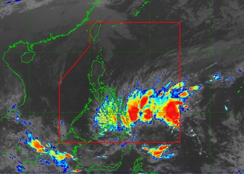
The center of Tropical Storm Basyang was estimated at 515 kilometers East of Hinatuan, Surigao del Sur packing maximum sustained winds of 65 kilometers per hour near the center, gustiness of up to 80 km/h, and central pressure of 1000 hPa.
Basyang is moving westward at the speed of 15 km/h with strong to gale-force winds extend outwards up to 300 km from the center.
Areas under Tropical Cyclone Wind Signal (TCWS) No.2 are the following:
Mindanao:
- the southern portion of Surigao del Norte (Claver, Gigaquit, Bacuag, Alegria) including Siargao - Bucas Grande Islands
- Surigao del Sur
- the extreme northern portion of Davao Oriental (Boston)
- Agusan del Norte
- the northern and eastern portions of Agusan del Sur (Trento, Bunawan, Rosario, San Francisco, Prosperidad, City of Bayugan, Sibagat, Esperanza, San Luis, Talacogon)
- the southeastern portion of Misamis Oriental (Magsaysay, Gingoog City, Claveria)
- the northeastern portion of Bukidnon (Impasug-Ong, Manolo Fortich, Malitbog, Sumilao)
Areas under TCWS No.1 are the following:
Visayas
- The central and southern portions of Eastern Samar (Guiuan, Salcedo, Mercedes, Giporlos, Balangiga, Lawaan, Quinapondan, General Macarthur, Hernani, Llorente, Maydolong, Balangkayan, City of Borongan, San Julian, Sulat, Taft)
- the southern portion of Samar (Marabut, Basey, Santa Rita, Villareal, Pinabacdao, Calbiga, Hinabangan, San Sebastian, Talalora, Daram, Zumarraga)
- Biliran
- Leyte
- Southern Leyte
- Bohol
- Cebu
- Siquijor
- Negros Oriental
- Negros Occidental
- Guimaras
- Iloilo
- the eastern portion of Capiz (Pilar, President Roxas, Ma-Ayon, Cuartero, Dumarao, Tapaz, Dumalag)
- the southeastern portion of Antique (Valderrama, San Remigio, Sibalom, Hamtic, Tobias Fornier, Anini-Y)
Mindanao:
- Dinagat Islands
- the rest of Surigao del Norte
- the northern portion of Davao Oriental (Cateel, Baganga, Caraga)
- the northern and central portions of Davao de Oro (Compostela, Monkayo, Montevista, Laak, New Bataan, Nabunturan, Mawab)
- the northern and central portions of Davao del Norte (Kapalong, San Isidro, Asuncion, New Corella, Talaingod)
- the rest of Agusan del Sur
- Camiguin
- the rest of Misamis Oriental
- the rest of northern and eastern portions of Bukidnon (San Fernando, City of Malaybalay, Cabanglasan, Libona, Baungon, Lantapan, City of Valencia, Talakag)
- the eastern portion of Lanao del Norte (Iligan City, Tagoloan, Pantar, Baloi, Matungao, Linamon, Kauswagan, Poona Piagapo, Pantao Ragat, Bacolod, Maigo)
- the northeastern portion of Lanao del Sur (Tagoloan II, Bubong, Kapai, Maguing, Marawi City, Saguiaran, Ditsaan-Ramain, Buadiposo-Buntong)
- the northern and central portions of Misamis Occidental (Clarin, Tudela, Sinacaban, Don Victoriano Chiongbian, Jimenez, Aloran, Panaon, Oroquieta City, Lopez Jaena, Plaridel, Baliangao, Calamba, Sapang Dalaga, Concepcion)
- the eastern portion of Zamboanga del Norte (Mutia, Piñan, Polanco, Dipolog City, Dapitan City, Sibutad, Rizal, La Libertad)
Heavy Rainfall Outlook
From Wednesday evening to Thursday evening (February 5), the rainfall outlook:
(100-200 mm): Agusan del Norte, Agusan del Sur, Dinagat Islands, Surigao del Norte, Surigao del Sur, Misamis Oriental, Davao de Oro, and Davao Oriental
(50-100 mm): Southern Leyte, Eastern Samar, Bukidnon, Misamis Occidental, Lanao del Norte, Lanao del Sur, and Davao del Norte
Severe Winds
"The wind signals warn the public of the general wind threat over an area due to the tropical cyclone. Local winds may be slightly stronger/enhanced in coastal and upland/mountainous areas exposed to winds. Winds are less strong in areas sheltered from the prevailing wind direction," PAGASA reported.
The surge of the Northeast Monsoon will also bring strong to gale-force gusts over the following areas (especially in coastal and upland areas exposed to winds): Metro Manila, Apayao, Abra, Batanes, Babuyan Islands, northern portion of mainland Cagayan, Central Luzon, most of Southern Luzon, Visayas, and most of Mindanao
Coastal Flooding
The weather bureau also said there is a minimal to moderate risk of storm surge with peak heights reaching up to 2.0 meters within the next 48 hours over the low-lying or exposed coastal communities of Dinagat Islands, Surigao del Norte, Surigao del Sur, Agusan del Norte, Davao Oriental, Misamis Oriental, Camiguin, Leyte, Southern Leyte, Cebu, and Bohol.
Hazards affecting coastal waters
A Gale Warning is in effect over the eastern seaboards of Visayas and Mindanao. Sea travel is risky and all mariners must remain in port or, if underway, seek shelter or safe harbor as soon as possible until winds and waves subside.
Track and Intensity Outlook
"Basyang will move generally westward for the next 24 hours before turning west northwestward beginning this evening," said PAGASA.
The center of Basyang will make its initial landfall over eastern Mindanao between Thursday evening and early Friday morning.
The tropical storm will traverse the landmass of northeastern Mindanao and Central and Western Visayas and emerge over Sulu Sea by Frida evening or Saturday (07 February) morning.
By Saturday afternoon or evening, Basyang will cross the northern portion of Palawan, then re-emerge over the West Philippine Sea.
"Basyang is forecast to gradually intensify while over the Philippine Sea. After its initial landfall, it will weaken into a tropical depression while traversing Visayas and will be downgraded to low pressure area by Sunday (08 February)," said PAGASA. — BAP, GMA Integrated News
