

Basyang moves over Bohol Sea, Signal No. 2 up in 15 areas
Tropical Cyclone Wind Signal No. 2 is hoisted over 15 areas in the Visayas and Mindanao as Tropical Storm Basyang moved to Bohol Sea on Friday morning, state weather bureau PAGASA said.
In its 8 a.m. bulletin, PAGASA said the following areas are under Tropical Cyclone Wind Signals:
Signal No. 2
Visayas
- The southern portion of Leyte (Matalom, Bato, Hilongos, Hindang)
- Southern Leyte
- Bohol
- The central and southern portions of Cebu (Samboan, Malabuyoc, Oslob, Ginatilan, Alegria, Dalaguete, Boljoon, Alcoy, Santander, Argao, Badian, Moalboal, Ronda, Alcantara, Sibonga, Dumanjug, City of Carcar, Barili, Aloguinsan, San Fernando, Pinamungahan, City of Naga, Lapu-Lapu City, Cordova, Cebu City, City of Talisay, Minglanilla, Toledo City, Mandaue City, Consolacion, Liloan)
- Siquijor
- Negros Oriental
- and the southern portion of Negros Occidental (Candoni, City of Sipalay, Ilog, City of Kabankalan, Cauayan, Hinoba-An, City of Himamaylan, Binalbagan, Isabela, Moises Padilla, La Castellana, Valladolid, Pulupandan, La Carlota City, San Enrique, Pontevedra, Hinigaran)
Mindanao
- Dinagat Islands
- Surigao del Norte
- The northern portion of Surigao del Sur (Lanuza, San Miguel, Tago, Carmen, Cortes, City of Tandag, Madrid, Cantilan, Carrascal)
- Agusan del Norte
- The northern portion of Agusan del Sur (City of Bayugan, Sibagat, Esperanza)
- Camiguin
- Misamis Oriental
- and the eastern portion of Misamis Occidental (Baliangao, Plaridel, Lopez Jaena, Oroquieta City, Calamba, Aloran, Panaon)
Signal No. 1
Luzon
- The southern portion of Occidental Mindoro (San Jose, Magsaysay, Rizal, Calintaan, Sablayan)
- The southern portion of Oriental Mindoro (Mansalay, Bulalacao, Gloria, Pinamalayan, Bansud, Bongabong, Roxas)
- Romblon
- The northern portion of Palawan (Taytay, El Nido, Dumaran, Araceli, Roxas, San Vicente) including Calamian, Cuyo, and Cagayancillo Islands
- and the southern portion of Masbate (Mandaon, Milagros, Balud, Placer, Cawayan, Esperanza)
Visayas
- The southern portion of Eastern Samar (Guiuan, Salcedo, Mercedes, Giporlos, Balangiga, Lawaan, Quinapondan, General Macarthur, Hernani, Llorente, Balangkayan, City of Borongan, Maydolong)
- The southern portion of Samar (Marabut, Basey, Santa Rita, Daram, Talalora, Zumarraga, Villareal, Pinabacdao, Calbiga)
- Biliran
- The rest of Leyte
- The rest of Cebu
- The rest of Negros Occidental
- Guimaras
- Iloilo
- Capiz
- Aklan
- Antique
- Mindanao
- The central portion of Surigao del Sur (Hinatuan, Tagbina, Barobo, Lianga, San Agustin, Marihatag, Cagwait, Bayabas)
- The central portion of Agusan del Sur (Loreto, Bunawan, Rosario, San Francisco, La Paz, Talacogon, San Luis, Prosperidad)
- The northern and central portions of Bukidnon (Lantapan, City of Valencia, Talakag, Don Carlos, Maramag, Kalilangan, Pangantucan, Cabanglasan, City of Malaybalay, Libona, Manolo Fortich, Malitbog, Impasug-Ong, Sumilao, Baungon)
- Lanao del Norte
- The rest of Misamis Occidental
- Lanao del Sur
- The eastern and central portions of Zamboanga del Norte (Mutia, Piñan, Polanco, Dipolog City, Dapitan City, Sibutad, Rizal, La Libertad, Salug, Bacungan, Sindangan, Jose Dalman, Manukan, Pres. Manuel A. Roxas, Katipunan, Sergio Osmeña Sr., Siayan, Godod)
- The northern and central portions of Zamboanga del Sur (Bayog, Kumalarang, Pagadian City, Tigbao, Lakewood, Dumingag, Mahayag, Molave, Josefina, Tambulig, Aurora, Ramon Magsaysay, Sominot, Midsalip, Labangan, Tukuran)
- and the northeastern portion of Zamboanga Sibugay (Kabasalan, Diplahan, Buug, Siay)
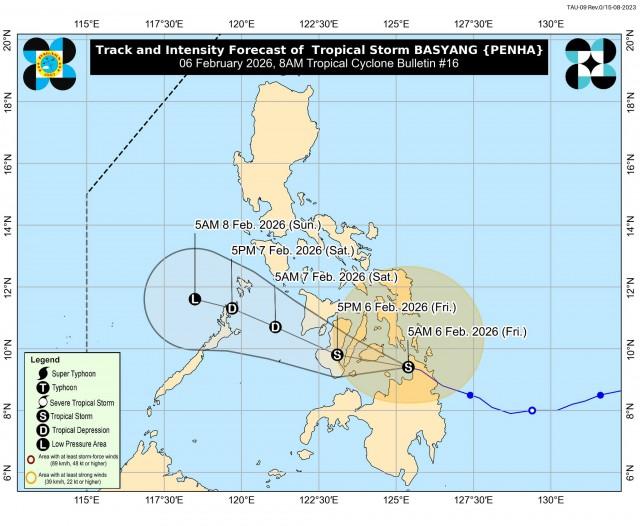
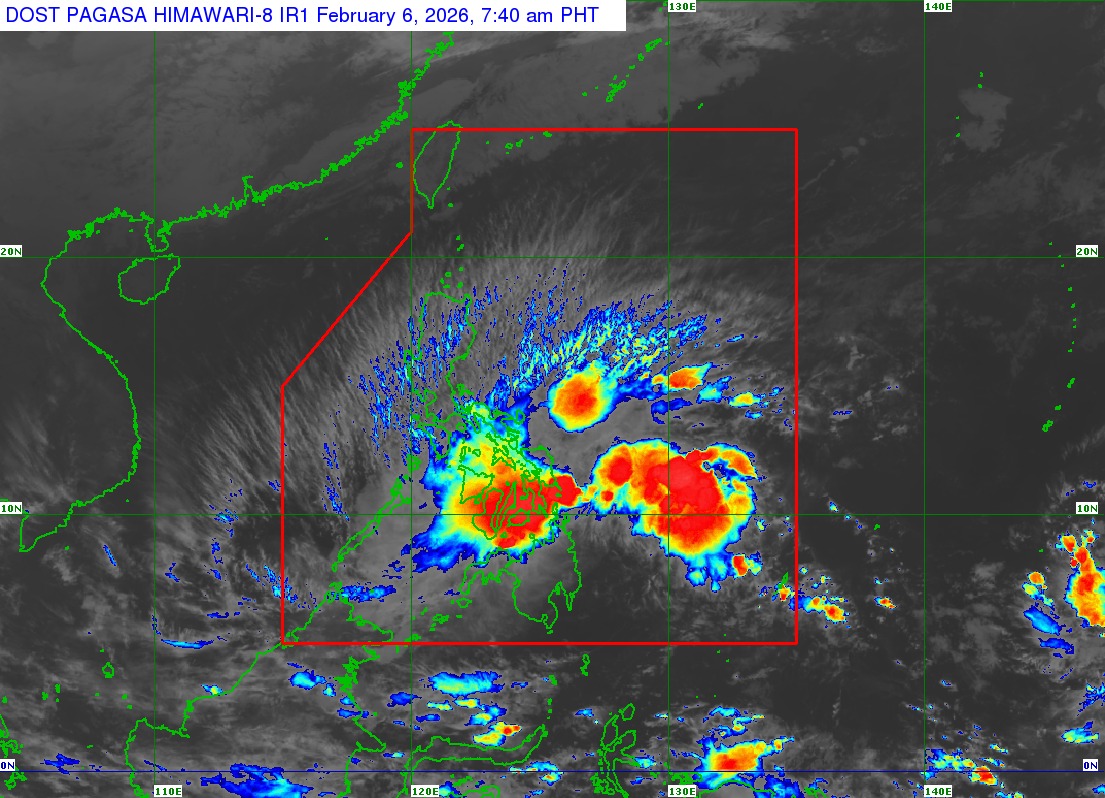
Basyang was last spotted over the coastal waters of Malimono, Surigao del Norte with maximum sustained winds of 65 kilometers per hour (kph) near the center and gustiness of up to 90 kph.
The tropical storm was moving west northwestward at 20 kph.
“On the forecast track, the center of BASYANG may pass close or make landfall over Bohol and southern portions of Cebu and Negros Oriental. Afterwards, it will emerge over Sulu Sea, pass close to Cuyo Islands, and cross the northern portion of Palawan,” PAGASA said.
“BASYANG will likely remain a tropical storm while traversing the Central Visayas and Negros Island Region. Further weakening into a tropical depression is possible tonight or tomorrow morning and will be downgraded into a low pressure area by Sunday (08 February) morning,” it added.
Classes have been suspended in some areas due to inclement weather brought about Basyang.
The local government of Hinatuan, Surigao del Sur has also enforced preemptive evacuations in preparation for the possible effects of Basyang. —VAL, GMA Integrated News
