

Tropical cyclone being monitored may turn into Super Typhoon, enter PAR in coming days
An active tropical cyclone outside the Philippine Area of Responsibility (PAR) may enter in the coming week and develop into a super typhoon, according to a Balitanghali report Thursday.
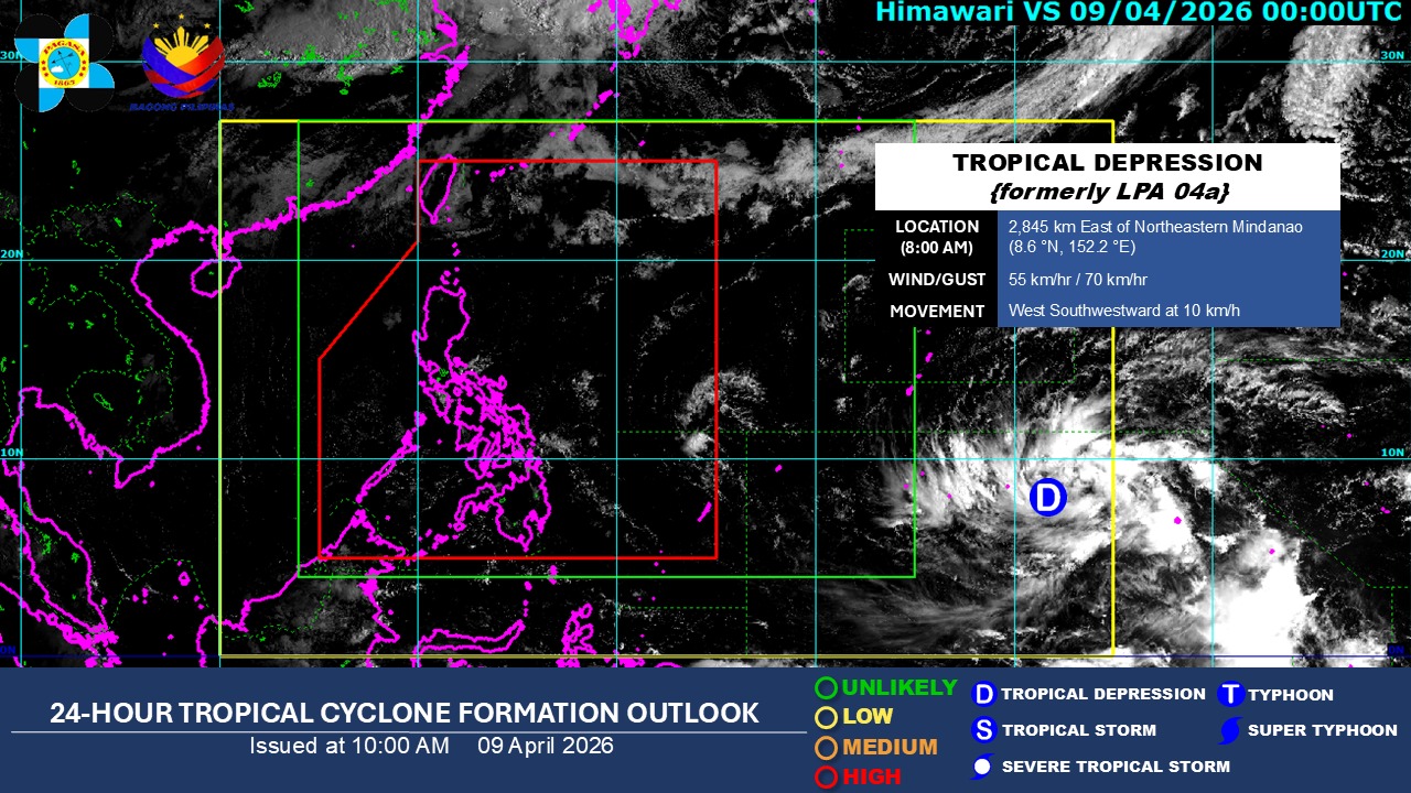
The tropical cyclone was last seen 2,845 kilometers east of northeastern Mindanao with maximum sustained winds of 55 kph and gustiness of up to 70 kph.
EXPLAINER: What is a super typhoon
Upon its entry to the PAR, the tropical cyclone will be named "Caloy."
Rainfall might occur in the eastern parts of the country, particularly Eastern Visayas.
Currently, the cyclone has no effects on the country.
PAGASA also said that there are chances of the cyclone changing directions and a low chance of a landfall scenario.
As of 4 a.m., the ridge of a high pressure area (HPA) will be extending over Northern and Central Luzon as localized thunderstorms bring rains over parts of the Philippines.
—Jiselle Anne C. Casucian/ VAL, GMA News
