

Tropical storm remains active outside PAR – PAGASA
The state weather bureau continues to monitor an active tropical cyclone outside the Philippine Area of Responsibility (PAR) as the ridge of a High Pressure Area (HPA) affects Northern Luzon.
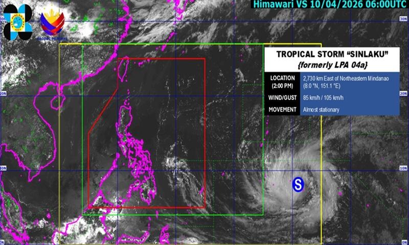
According to PAGASA’s daily weather forecast on Friday afternoon, Tropical Storm Sinlaku was last seen at 2,730 kilometers east of Northeastern Mindanao as of 3 p.m.
Sinlaku currently has maximum sustained winds of 85 kph and a gustiness of up to 105 kph.
Partly cloudy to cloudy skies with isolated rain showers or thunderstorms will be felt over the country due to localized thunderstorms.
Possible flash floods or landslides may occur in some areas as a result of the said weather conditions.
Meanwhile, light to moderate winds with slight to moderate coastal waters will be observed nationwide.
Sunrise in Metro Manila will be at 5:45 a.m. on Saturday. — BAP, GMA News
