

Nearest LPA outside PAR 'unlikely' to become storm — PAGASA
The nearest low pressure area (LPA) outside the Philippine Area of Responsibility (PAR) is “unlikely” to develop into a tropical depression within the next 24 hours, PAGASA said Monday afternoon.
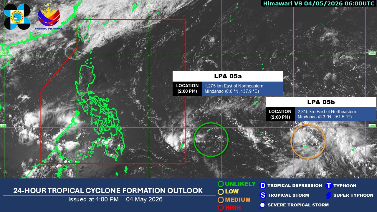
As of 2 p.m., the state weather advisory said LPA 05a was located 1,275 kilometers east of Northeastern Mindanao.
Meanwhile, another LPA was observed 2,815 km east of Northeastern Mindanao outside PAR.
PAGASA said LPA 05b has a “medium” chance of becoming a tropical depression within the next 24 hours.
It advised the public to monitor updates on its official platforms.
For now, the easterlies will bring cloudy skies and rain in several areas in the country in the next 24 hours, according to PAGASA’s 4 p.m. weather forecast.
Zamboanga Peninsula and Palawan will see cloudy skies with scattered rains and thunderstorms due to the easterlies.
Partly cloudy to cloudy skies with isolated rain showers or thunderstorms will persist in Metro Manila and the rest of the country, also due to the easterlies.
PAGASA warned that these weather conditions may trigger flash floods or landslides.
State meteorologists also said winds will be moderate to strong, while coastal waters will be moderate to rough in extreme Northern Luzon.
The rest of the country will experience light to moderate winds and slight to moderate coastal waters.
Sunrise in Metro Manila will be at 5:32 a.m. on Tuesday. —Mariel Celine Serquiña/RF, GMA News
