

Super Typhoon Francisco weakens into typhoon; Signal No. 1 up over 2 areas
Two areas in Luzon were placed under Tropical Cyclone Wind Signal No. 1 as Francisco (international name: Mekkhala) weakened into a typhoon over the Philippine Sea east of Babuyan Islands, PAGASA said Tuesday.
In its 11 a.m. bulletin, PAGASA said the following areas were under TCWS No. 1:
- Batanes; and
- the northeastern portion of Cagayan (Gonzaga, Santa Ana) including the eastern portion of Babuyan Islands (Babuyan Island, Didicas Island, Camiguin Island).
Under TCWS No. 1, winds of 39-61 km/h may be expected in at least 36 hours or intermittent rains may be expected within 36 hours.
Further, minimal to minor impacts from strong winds are possible within any of the areas under TCWS No. 1.
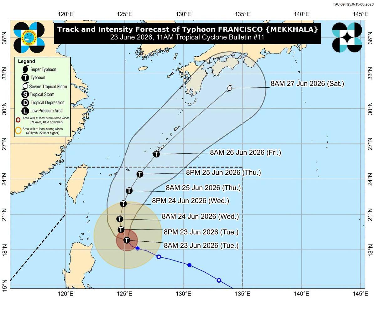
“Should there be a significant westward shift in the forecast track, Wind Signal No.2 may be hoisted in some localities of Babuyan Islands and Batanes. However, this scenario is becoming less likely as FRANCISCO is now moving a more northwestward track,” PAGASA said.
Meanwhile, the Southwest Monsoon (Habagat) and the periphery of Typhoon Francisco will bring strong to gale-force gusts over the following areas (especially in coastal and upland areas exposed to winds) on Tuesday:
- Most of Luzon
- Visayas
- Zamboanga Peninsula
- Northern Mindanao
- Surigao del Norte
- Dinagat Islands
- Davao Occidental, and
- Davao Oriental.
PAGASA said the tropical cyclone will remain far from the Philippine landmass.
“FRANCISCO is forecast to gradually decelerate while moving generally north northwestward until tomorrow (24 June) morning before recurving towards the Ryukyu Islands in southern Japan. On the track forecast, FRANCISCO will exit the Philippine Area of Responsibility (PAR) on Friday (26 June) morning,” the state weather bureau said.
Further, Typhoon Francisco may still further intensify or maintain its strength until Tuesday afternoon. PAGASA said a weakening trend will be expected due to increasingly unfavorable environmental conditions.
The center of the eye of Typhoon Francisco was estimated based on all available data at 375 km East Northeast of Aparri, Cagayan or 380 km East of Calayan, Cagayan (19.1 °N, 125.1 °E )
Moving west northwestward at 10 km/h, it has maximum sustained winds of 175 km/h near the center and gustiness of up to 215 km/h. —KG, GMA News
