

Super Typhoon Bavi continues to strengthen outside PAR
Super Typhoon Bavi continued to intensify over the waters outside the Philippine Area of Responsibility (PAR), the state weather bureau PAGASA said Saturday.
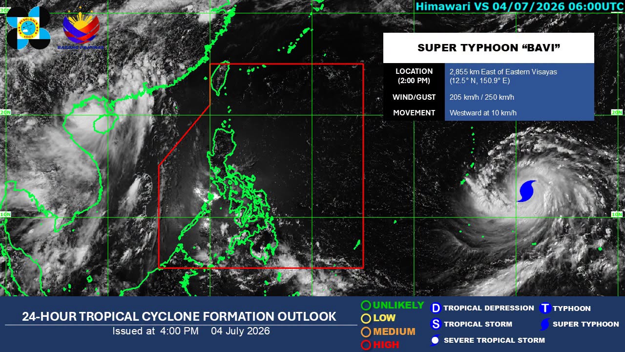
Over the past 12 hours, Bavi's maximum sustained winds increased from 195 kilometers per hour (km/h) near the center at 3 a.m. to 205 km/h as of 3 p.m.
Its peak gusts also strengthened from 240 km/h to 250 km/h. However, the super typhoon slowed slightly, moving westward at 10 km/h from its previous speed of 15 km/h.
As of 3 p.m., Bavi was located 2,845 kilometers east of Eastern Visayas.
The cyclone is forecast to enter the PAR by the middle of next week, when it will be assigned the local name Inday.
Although Bavi currently has a low likelihood of making landfall, it is expected to enhance the Southwest Monsoon (Habagat), bringing rains over the western sections of the country, according to PAGASA weather specialist Veronica Torres.
Over the next 24 hours, the easterlies will affect Cagayan Valley, the Bicol Region, Eastern Visayas, Aurora, Quezon, and the Dinagat Islands.
Meanwhile, Metro Manila and the rest of the country will experience partly cloudy to cloudy skies with isolated rain showers or thunderstorms due to localized thunderstorms.
PAGASA warned of flash floods or landslides during severe thunderstorms.
Light to moderate winds and slight to moderate coastal waters are expected across the country.
Sunrise in Metro Manila on Sunday will be at 5:32 a.m. —Lyjah Tiffany Bonzo/VBL, GMA News
