

 GMA Brandtalk
 Tracking
 Archives

Super Typhoon Bavi slightly accelerates, may enter PAR by Tuesday
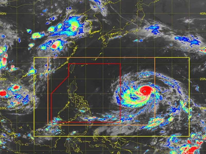
Super Typhoon Bavi slightly accelerates as it continues to move west northwestward late Monday evening, according to the Tropical Cyclone Bulletin posted by PAGASA.
The center of the eye of Super Typhoon Bavi was estimated at 1,950 kilometers east of Southeastern Luzon outside the Philippine Area of Responsibility (PAR), packing maximum sustained winds of 205 kilometers per hour near the center and gustiness of up to 250 km/h.
Bavi is moving west northwestward at the speed of 25 km/h with strong to typhoon-force winds extend outwards up to 800 km from the center.
Bavi is forecast to move generally west northwestward and will enter the Philippine Area of Responsibility (PAR) between Tuesday evening and early morning on Wednesday.
PAGASA said that inside the PAR, the tropical cyclone will be given the local name Inday. While over the Philippine Sea, it will move generally northwestward towards Ryukyu Islands.
"This tropical cyclone is forecast to maintain its strength as Super Typhoon as it enters PAR. Gradual weakening is expected as it moves near Extreme Northern Luzon while approaching the east of Taiwan," the state weather bureau said.
"Despite the low chance of landfall over any parts of Luzon, considering the intensity and the extent of the strong winds from the center of Super Typhoon BAVI, wind signals may be raised over the northern and eastern portions of Northern Luzon (earliest by tomorrow night or Wednesday morning)," it added.
With the uncertainty in terms of radius of strong winds, PAGASA said there is possibility that wind signals will be raised over the eastern portions of Southern Luzon and Visayas.
"Gusty conditions over most parts of the country are likely to begin between tomorrow and Wednesday due to the Southwest Monsoon. The enhanced Southwest Monsoon and the tropical cyclone will also bring heavy rains to the northern and western portions of the country," the agency said. — BAP, GMA News

