

 GMA Brandtalk
 Tracking
 Archives

Super Typhoon Inday's strength maintained, Signal No. 1 for 12 Luzon areas
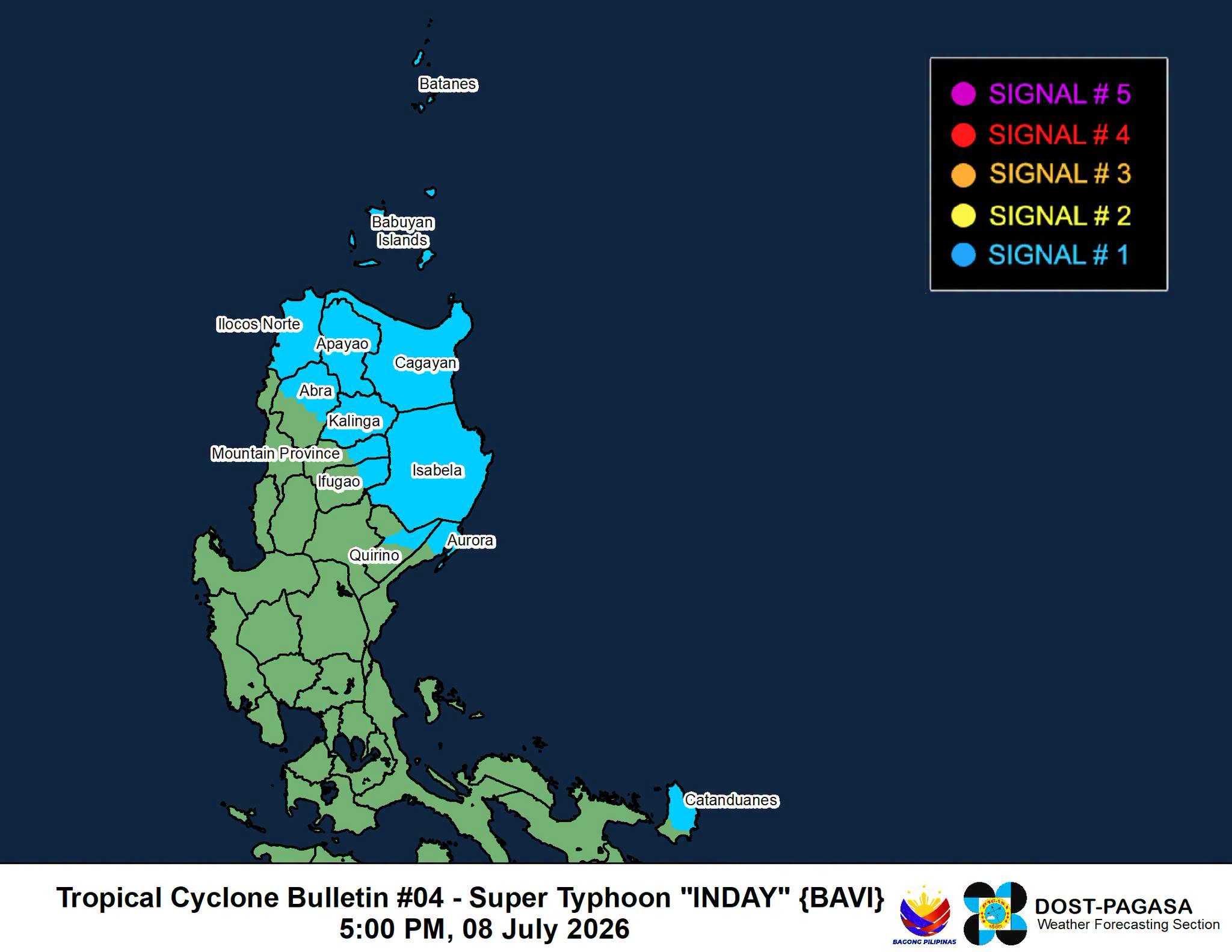
Twelve areas in Luzon are under Signal No. 1 as Super Typhoon Inday (international name: Bavi) maintained its strength while moving westward over the Philippine Sea east of northern Luzon, the state weather bureau PAGASA said on Wednesday afternoon.
According to the 5 p.m. tropical cyclone bulletin, the center of the eye of Inday was last seen at 1,070 kilometers east northeast of southeastern Luzon.
The super typhoon has maximum sustained winds of 195 kilometers per hour near the center and gustiness of up to 240 kilometers per hour. Inday is also moving westward at 20 kilometers per hour.
The following areas are under Signal No. 1 and could expect winds of 39 to 61 kilometers per hour:
- Batanes,
- Cagayan including Babuyan Islands,
- Apayao,
- Kalinga,
- Isabela,
- the northern portion of Aurora (Dilasag, Casiguran),
- the northern and central portions of Catanduanes (Pandan, Caramoran, Bagamanoc, Panganiban, Viga, Gigmoto, Baras, San Miguel),
- the northeastern portion of Quirino (Maddela),
- the eastern portion of Ifugao (Aguinaldo, Alfonso Lista),
- Ilocos Norte,
- the eastern portion of Mountain Province (Natonin, Paracelis) and
- the northern portion of Abra (Tineg, Lagayan, Danglas, San Juan, Lagangilang, Licuan-Baay, Malibcong, Lacub, Daguioman, Dolores, La Paz)
PAGASA warned of minimal to minor threat to life and property in the abovementioned areas in Luzon.
Further, the state weather bureau said that up to Wind Signal No. 2 or 3 may be hoisted throughout Inday’s passage.
Inday is forecast to move generally west-northwestward over the next 12 hours, said PAGASA. The super typhoon will maintain its strength as a super typhoon until Thursday, July 9. Afterwards, it is forecast to weaken into a typhoon by tomorrow evening or Friday early morning until it exits the Philippine Area of Responsibility (PAR).
It is forecast to exit PAR by Saturday, July 11. –NB, GMA News

