

 GMA Brandtalk
 Tracking
 Archives

LPA enters PAR, has high chance of developing into tropical depression in 24 hours
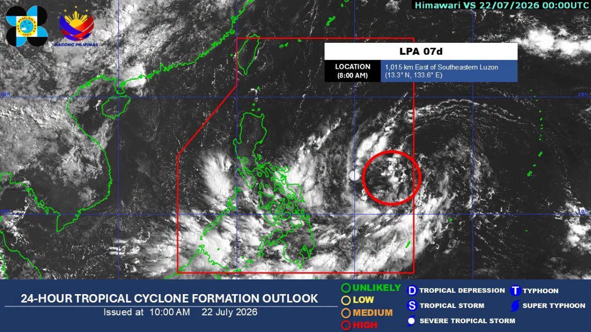
The low pressure area (LPA) located east of Southeastern Luzon entered the Philippine Area of Responsibility (PAR) on Wednesday morning, PAGASA said.
The weather bureau said the LPA entered PAR at 8 a.m.
The LPA has a "high" chance of developing into a tropical depression within the next 24 hours, it added.
As of 8 a.m., the LPA was located 1,015 km east of Southeastern Luzon.
Meanwhile, in its 11 a.m. heavy rainfall outlook for the LPA, PAGASA said 50 to 100 mm of rainfall is expected in Cagayan from Thursday noon (July 23) to Friday noon (July 24).
Heavy to intense rains measuring 100 to 200 mm may occur from Friday noon to Saturday noon (July 25) in Cagayan, Apayao, Abra, Ilocos Norte, and Ilocos Sur.
Batanes, Isabela, Kalinga, Mountain Province, Ifugao, Benguet, and La Union may expect moderate to heavy rains (50-100 mm) from Friday noon to Saturday noon (July 25).
Habagat
The Southwest Monsoon (Habagat) meanwhile continues to affect the country.
PAGASA said 50 to 100 mm of rainfall is expected today until noontime of Thursday, July 23 in Lanao del Sur, Maguindanao del Norte, Sultan Kudarat, and Sarangani.
From Thursday noon to Friday noon (July 24), some 50 to 100 mm of rainfall may be experienced in Antique, Negros Occidental, Negros Oriental, Zamboanga Sibugay, Zamboanga del Sur, Lanao del Norte, Lanao del Sur, Maguindanao del Norte, Sultan Kudarat, and Sarangani.
From Friday noon to Saturday noon (July 25), Occidental Mindoro, Antique, Iloilo, Guimaras, Negros Occidental, and Negros Oriental may have 50 to 100 mm of rainfall.
"Forecast rainfall may be higher in mountainous and elevated areas. Moreover, impacts in some areas may be worsened by significant antecedent rainfall," PAGASA said.
The weather bureau advised the public and disaster risk reduction and management offices concerned to take the necessary measures to protect life and property. —KG, GMA News

