

 GMA Brandtalk
 Tracking
 Archives

Kiyapo slightly intensifies, Signal No. 2 raised in 5 areas
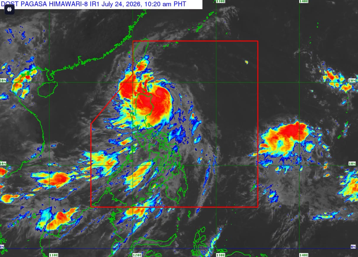
Tropical Storm Kiyapo slightly intensifies as it moves closer to extreme Northern Luzon, PAGASA said Friday.
As of 10 a.m., the center of Kiyapo was estimated at 135 km East of Aparri, Cagayan, with maximum sustained winds of 75 kph and gusts up to 90 kph.
Tropical cyclone wind signals are raised in the following areas:
Signal No. 2
- Batanes
- Northern portion of Cagayan (Santa Ana, Gonzaga, Santa Teresita, Camalaniugan, Aparri, Ballesteros, Abulug, Pamplona, Sanchez-Mira, Claveria, Santa Praxedes, Buguey, Allacapan, Lal-Lo, Gattaran, Baggao, Lasam)
- Babuyan Islands
- Northern portion of Apayao (Luna, Santa Marcela, Calanasan, Pudtol, Flora)
- Northern portion of Ilocos Norte (Pagudpud, Dumalneg, Adams, Bangui, Burgos, Vintar)
Signal No. 1
- the rest of mainland Cagayan
- Isabela
- Quirino
- Nueva Vizcaya
- the rest of Apayao
- Abra
- Kalinga
- Mountain Province
- Ifugao
- Benguet
- the rest of Ilocos Norte, Ilocos Sur, and La Union
- Northern and central portions of Aurora (Dilasag, Casiguran, Dinalungan, Dipaculao)
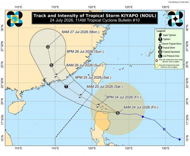
According to PAGASA, the potential impacts of winds include minimal to minor threat to life and property.
Meanwhile, the Southwest Monsoon or Habagat and the periphery of Kiyapo are also expected to bring strong to gale-force gusts over the following areas:
Today, July 24 - most of the country
July 25 - Most of Luzon and Visayas, Zamboanga del Norte, and Davao Oriental
July 26 - Ilocos Region, MIMAROPA, Zambales, Bataan, and Quezon
Tropical Storm Kiyapo is forecast to exit the Philippine Area of Responsibility (PAR) by the morning of July 25, 2026, according to PAGASA. —VAL, GMA News

