

 GMA Brandtalk
 Tracking
 Archives

Kiyapo now a severe tropical storm; Signal No. 3 over western Babuyan Islands
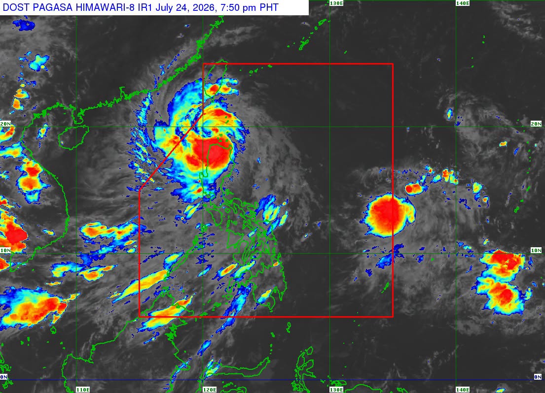
Tropical cyclone Kiyapo intensified into a severe tropical storm as it exited the Babuyan Islands, PAGASA said in its 8 p.m. bulletin on Friday.
Tropical Cyclone Wind Signal No. 3 was raised over the western portion of the Babuyan Islands (Calayan, Dalupiri, Fuga).
Under Signal No. 2 are:
- Batanes
- the rest of Babuyan Islands
- the northern portion of mainland Cagayan (Santa Ana, Gonzaga, Santa Teresita, Camalaniugan, Aparri, Ballesteros, Abulug, Pamplona, Sanchez-Mira, Claveria, Santa Praxedes, Buguey, Allacapan, Lal-Lo, Gattaran, Baggao, Lasam)
- the northern portion of Apayao (Luna, Santa Marcela, Calanasan, Pudtol, Flora)
- the northern portion of Ilocos Norte (Pagudpud, Dumalneg, Adams, Bangui, Burgos, Vintar)
Signal No. 1 was hoisted over:
- the rest of mainland Cagayan
- Isabela
- Quirino
- Nueva Vizcaya
- the rest of Apayao
- Abra
- Kalinga
- Mountain Province
- Ifugao
- Benguet
- the rest of Ilocos Norte
- Ilocos Sur
- La Union
- the northern and central portions of Aurora (Dilasag, Casiguran, Dinalungan, Dipaculao)
As of 7 p.m., Kiyapo was over the coastal waters of Calayan Island, packing maximum sustained winds of 95 km/h near the center and gustiness of up to 130 km/h. It was moving west northwestward at 25 km/h, slower than its previous speed of 30 km/h.
PAGASA said the tropical cyclone is expected to exit the Philippine Area of Responsibility between late Friday evening and early Saturday morning.
"Kiyapo will continue to intensify while moving over the West Philippine Sea. Due to favorable environment conditions, it may undergo rapid intensification and may reach typhoon category before making landfall over southern mainland China. Afterwards, Kiyapo is expected to weaken as it moves further inland," PAGASA said. —VBL, GMA News

