

 GMA Brandtalk
 Tracking
 Archives

Signal No. 1 up over 4 Luzon areas as Tropical Depression Luis keeps strength
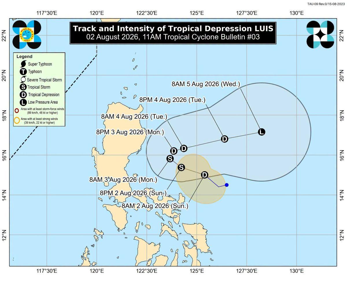
Tropical Cyclone Wind Signal No. 1 was raised over four areas in Luzon on Sunday morning as Tropical Depression Luis maintained its strength while moving northwestward over the sea east of Quezon Province.
According to PAGASA's 11 a.m. weather bulletin, winds of 39 to 61 kilometers per hour are expected over the following areas:
- Polillo Islands;
- Camarines Norte;
- northern portion of Camarines Sur (Caramoan, Presentacion, Garchitorena, Lagonoy, Tinambac, Siruma, Goa, San Jose, Tigaon, Calabanga); and
- Catanduanes.
The center of Luis was last monitored at 10 a.m. at 400 kilometers east of Infanta, Quezon.
It has maximum sustained winds of 55 kilometers per hour near the center, and gustiness of up to 70 kilometers per hour.
Luis is moving northwestward at 15 kilometers per hour, said PAGASA.
"Luis is forecast to intensify into a tropical storm in the next 24 hours while moving over the sea east of Central Luzon. It will likely remain a tropical storm for only a short period," said PAGASA.
"Afterwards, as Luis begins to turn generally east northeastward, a weakening trend is expected. It may be downgraded into a remnant low by Wednesday (05 August) before becoming fully assimilated into the circulation of Typhoon Dolphin," it added.
Typhoon Dolphin
Meanwhile, Dolphin is being monitored within the Tropical Cyclone Information Domain of PAGASA.
Dolphin, which will be locally named "Maymay" if it enters PAR, was last seen at 3,285 kilometers east of extreme northern Luzon.
It was a super typhoon but weakened into a typhoon on Sunday morning, PAGASA said.
—KG, GMA News

