

 GMA Brandtalk
 Tracking
 Archives

Maymay weakens as it leaves Philippine landmass
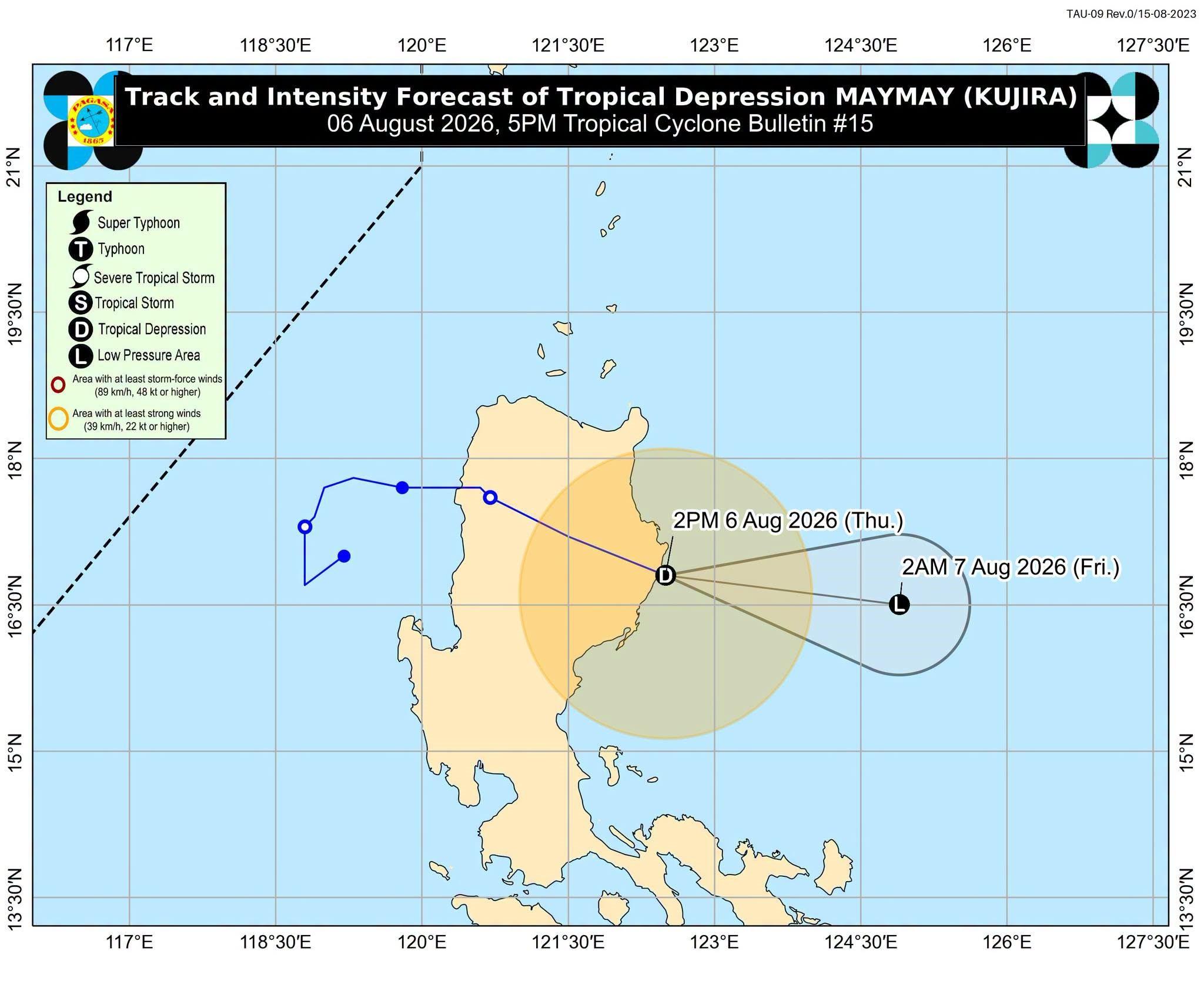
Tropical Depression Maymay (international name: Kujira) further weakened as it exited Philippine landmass on Thursday afternoon, according to state weather bureau PAGASA.
In its 5 p.m. weather bulletin, PAGASA said Maymay has crossed the Sierra Madre mountain range, which contributed to its further weakening. It is expected to dissipate by Thursday night or Friday morning.
However, the remnants of Maymay may merge with Typhoon Dolphin. Dolphin is currently outside the Philippine Area of Responsibility but is expected to strengthen the southwest monsoon, triggering rains across the Philippines.
Maymay is currently packing maximum sustained winds of 45 kph near the center and gusts of up to 60 kph. It is moving east southeastward at a pace of 35 kph.
PAGASA has retained tropical cyclone wind signal warning no. 1 over the following areas:
- The southeastern portion of mainland Cagayan (Tuao, Piat, Enrile, Alcala, Amulung, Baggao, Solana, Tuguegarao City, Gattaran, Peñablanca, Iguig)
- Isabela
- Quirino
- Northeastern portion of Nueva Vizcaya (Dupax del Norte, Kasibu, Quezon, Bagabag, Diadi, Bayombong, Ambaguio, Villaverde, Bambang, Solano, Alfonso Castañeda, Dupax del Sur)
- Northern and central portions of Aurora (Dilasag, Casiguran, Dinalungan, Dipaculao),
- Eastern portion of Kalinga (City of Tabuk, Pinukpuk, Tanudan, Lubuagan, Rizal)
- Eastern portion of Mountain Province (Paracelis, Natonin, Barlig)
- Eastern portion of Ifugao (Lagawe, Aguinaldo, Asipulo, Hingyon, Kiangan, Lamut, Alfonso Lista, Mayoyao, Banaue)
The state weather bureau said that areas outside of their forecast could still experience inclement weather. — VDV, GMA News

