

 GMA Brandtalk
 Tracking
 Archives

2 LPAs outside PAR have 'high' chances of becoming cyclones
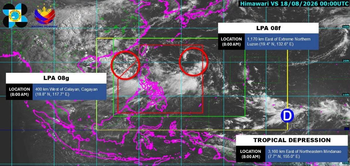
The state weather bureau on Tuesday monitored two low pressure areas (LPA) outside the Philippine Area of Responsibility (PAR) with "high" chances of becoming tropical depressions within the next 24 hours.
In a Facebook post, the Philippine Atmospheric, Geophysical and Astronomical Services Administration (PAGASA) said that as of 8 a.m., one LPA was 1,170 kms east of extreme northern Luzon.
The other LPA was located 400 kms west of Calayan, Cagayan.
PAGASA is also monitoring a tropical depression outside of PAR, around 3,160 kms east of northeastern Mindanao.
In its 11 a.m. weather advisory, PAGASA also warned of heavy rainfall due to the southwest monsoon. From Tuesday to Wednesday noon, Zambales, Bataan, Cavite, Batangas, and Occidental Mindoro could expect 100 to 200 mm of rain.
PAGASA warned the aforementioned areas of possible flooding events, especially in places that are urbanized, low-lying or near rivers. Landslides are also likely in highly susceptible areas.
Meanwhile, Metro Manila, La Union, Benguet, Pangasinan, Ilocos Sur, Abra, Tarlac, Pampanga, Bulacan, Nueva Ecija, Laguna, Rizal, Oriental Mindoro, and Antique could also expect 50 to 100 mm of rainfall.
These areas were warned of possible localized flooding and landslides. — VDV, GMA News

