

 GMA Brandtalk
 Tracking
 Archives

Typhoon Saudel moves over PH Sea; entering PAR as super typhoon not ruled out
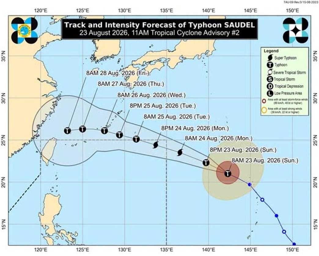
Typhoon Saudel remains outside of the Philippine Area of Responsibility (PAR) on Sunday morning as it moves west northwestward over the Philippine Sea east of extreme northern Luzon, state weather bureau PAGASA said.
According to PAGASA's 11 a.m. advisory, the center of Saudel was monitored 2,085 kilometers east of extreme northern Luzon.
It has maximum sustained winds of 165 kilometers per hour near the center, and gustiness of up to 205 kilometers per hour.
The typhoon is moving west northwestward at 25 kilometers per hour.
PAGASA said that Saudel is forecast to enter PAR by Monday morning or afternoon, August 24.
Further, state meteorologists explained that Saudel will be given the local name "Obet" or "Pilandok" depending on which will enter PAR first — Saudel or a tropical depression also being monitored.
Although forecast suggests that Saudel may reach the super typhoon category prior to its entry on Monday, reaching such category upon entering PAR is still not ruled out.
"This tropical cyclone is forecast to reach Super Typhoon category by tomorrow (24 August) prior to its entry to PAR. After reaching its peak intensity, a gradual weakening is expected but the possibility of SAUDEL entering PAR as a Super Typhoon is not ruled out," said PAGASA.
However, PAGASA said that Saudel is less likely to affect the weather and sea conditions in the country in the next three days. It is forecast to exit PAR by Tuesday, August 25. —KG, GMA News

