

 GMA Brandtalk
 Tracking
 Archives

Pilandok slightly intensifies, may exit PAR on Sept. 3, 2026
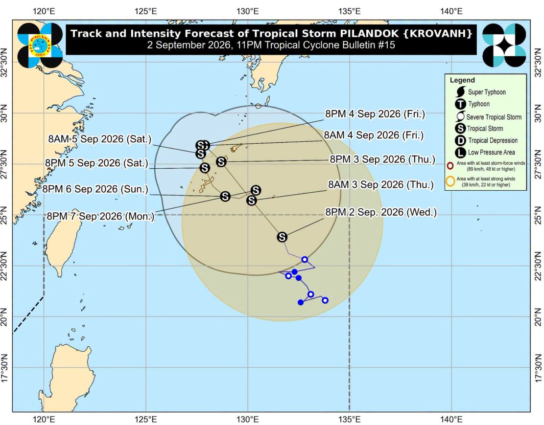
Tropical Storm Pilandok slightly intensifies as it moves north northwestward ove the Philippine Sea, weather bureau PAGASA said in its 11 p.m. cyclone bulletin.
The center of Pilandok was estimated at 1,070 kilometers East Northeast of Extreme Northern Luzon. It is moving westward at 15 km/h with maximum sustained winds of 75 km/h near the center and gustiness of up to 90 km/h.
While there is no Tropical Cyclone Wind Signal hoisted, PAGASA said to expect "strong to gale-force gusts" due to the Southwest Monsoon from Wednesday night until Friday over most of Luzon and Visayas, Zamboanga del Norte, Misamis Occidental, Lanao del Norte, Misamis Oriental, Camiguin, Dinagat Islands, Davao Occidental, and Davao Oriental.
Pilandok is forecast to move northwestward and exit the Philippine Area of Responsibility (PAR) by Thursday early morning.
"Outside the PAR, this tropical cyclone will continue moving northwestward towards southern Japan," PAGASA said.
"Beginning Friday (04 September) until Sunday (06 September), it will remain almost stationary then move generally southward, looping over the area of Okinawa-Amami islands. Afterwards, it will move east northeastward by Monday (07 September)," it added.
Pilandok will remain a tropical storm throughout the entire forecast period, PAGASA said. —LDF, GMA News

