

 GMA Brandtalk
 Tracking
 Archives

Tropical Storm Krovanh maintains strength, drifts out of PAR
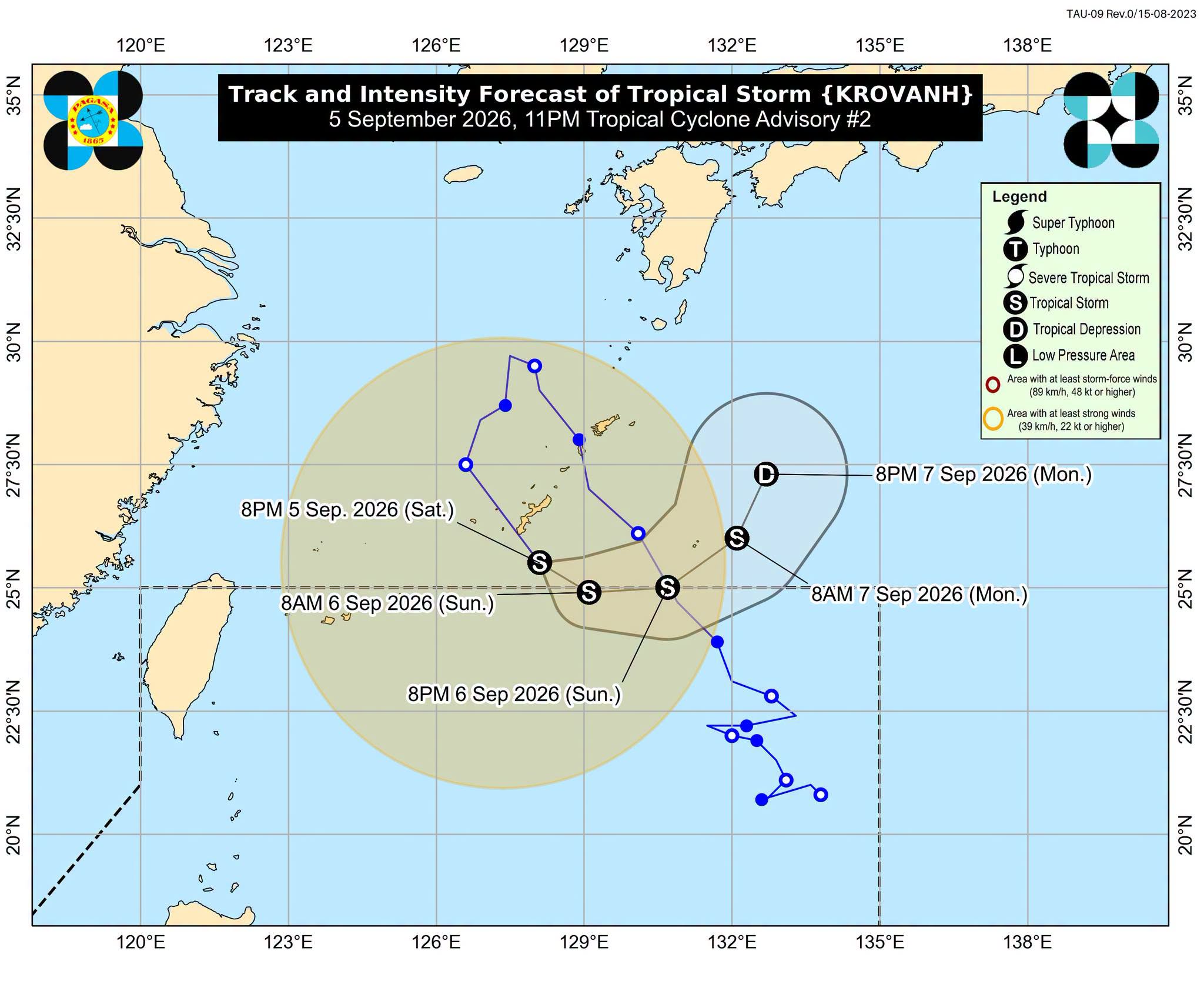
Tropical Storm Krovanh (formerly Pilandok) maintained its strength while moving southeastward outside the Philippine Area of Responsibility (PAR), the state weather bureau PAGASA said in its 11 p.m. advisory on Saturday.
As of 10 p.m., Krovanh was located 835 kilometers northeast of Extreme Northern Luzon.
It was moving southeastward at 20 kilometers per hour (kph), with maximum sustained winds of 65 kph near the center and gustiness of up to 80 kph.
PAGASA said Krovanh may maintain its strength over the next 36 hours before weakening into a tropical depression by Monday afternoon or evening.
It is expected to re-enter the PAR between the morning and early afternoon of September 6, 2026, at which point it will be called by its local name, Pilandok.
Krovanh has a low chance of making landfall in the country and is not expected to directly affect the Philippines' weather and sea conditions, PAGASA said.
“However, in the next 24 hours, the Southwest Monsoon (Habagat) may bring moderate to rough seas over the coastal waters of Batanes and Babuyan Islands while moderate seas [are expected] over the eastern and western seaboards of Luzon,” the weather bureau noted.
The tropical storm is expected to exit the PAR by Monday, September 7, 2026.
The state weather bureau advised the public and concerned disaster risk reduction and management offices to continue monitoring updates related to Krovanh. — MCG, GMA News

