
Filtered By: Topstories
News
INFOGRAPHIC: A visual history of the most destructive Philippine earthquakes
I just got a bit more curious about earthquakes occurring in the PH.
The infographic below tracks the thousands of quakes in the country since the 1970s, and lists the seven most destructive in our history, including the one that hit Bohol.
The infographic below tracks the thousands of quakes in the country since the 1970s, and lists the seven most destructive in our history, including the one that hit Bohol.
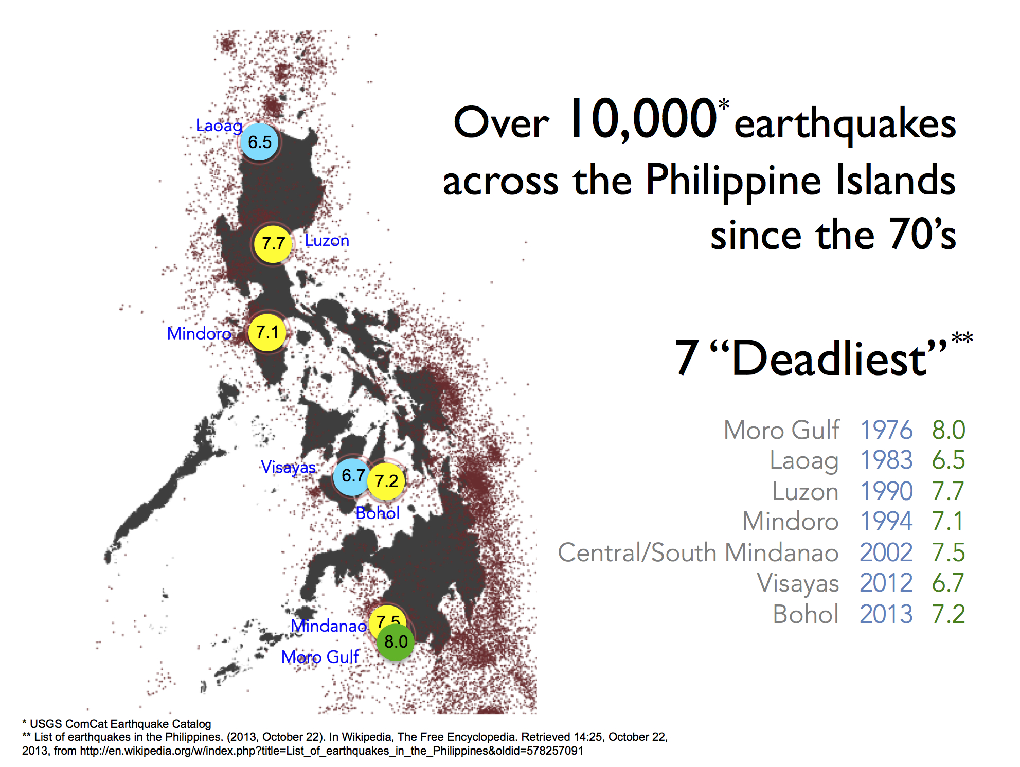
A history of destruction.
For the infograph below of the Bohol earthquake, the United States Geological Survey (USGS) only processed for download those earthquakes with magnitude 3.0 and above. I have extracted the data from their website, which is a resource provided in part by the US Earthquake Hazards Program.
The red and green dots indicate the "age" of the earthquake. The red dot (one-day old) indicates that an earthquake just recently hit the area; the green ones are those quakes that are more than a day old, beginning Oct 15.
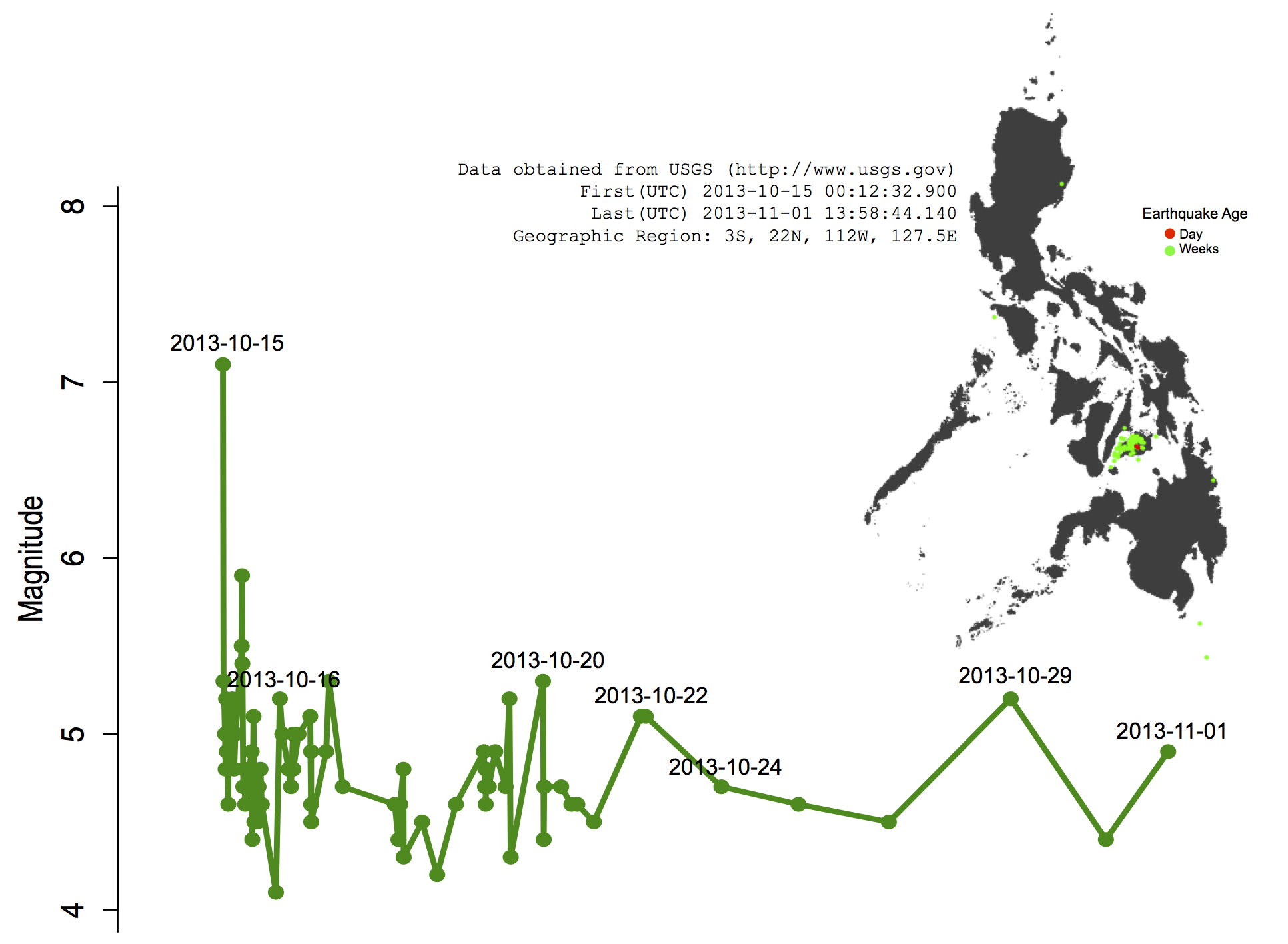
The Bohol quake and its aftershocks.
Editor's Note: These two infographs originally appeared on Filipina scientist EF Legara's website. We are re-posting them here with her permission to contextualize the recent earthquakes that hit Bohol and Cebu with our history of previous quakes.
EF Legara is a Filipina physicist and data scientist working on Complex Systems.
