

 GMA Brandtalk
 Tracking
 Archives

PhilSA maps show flooding, landslide extent due to Typhoon Inday, monsoon
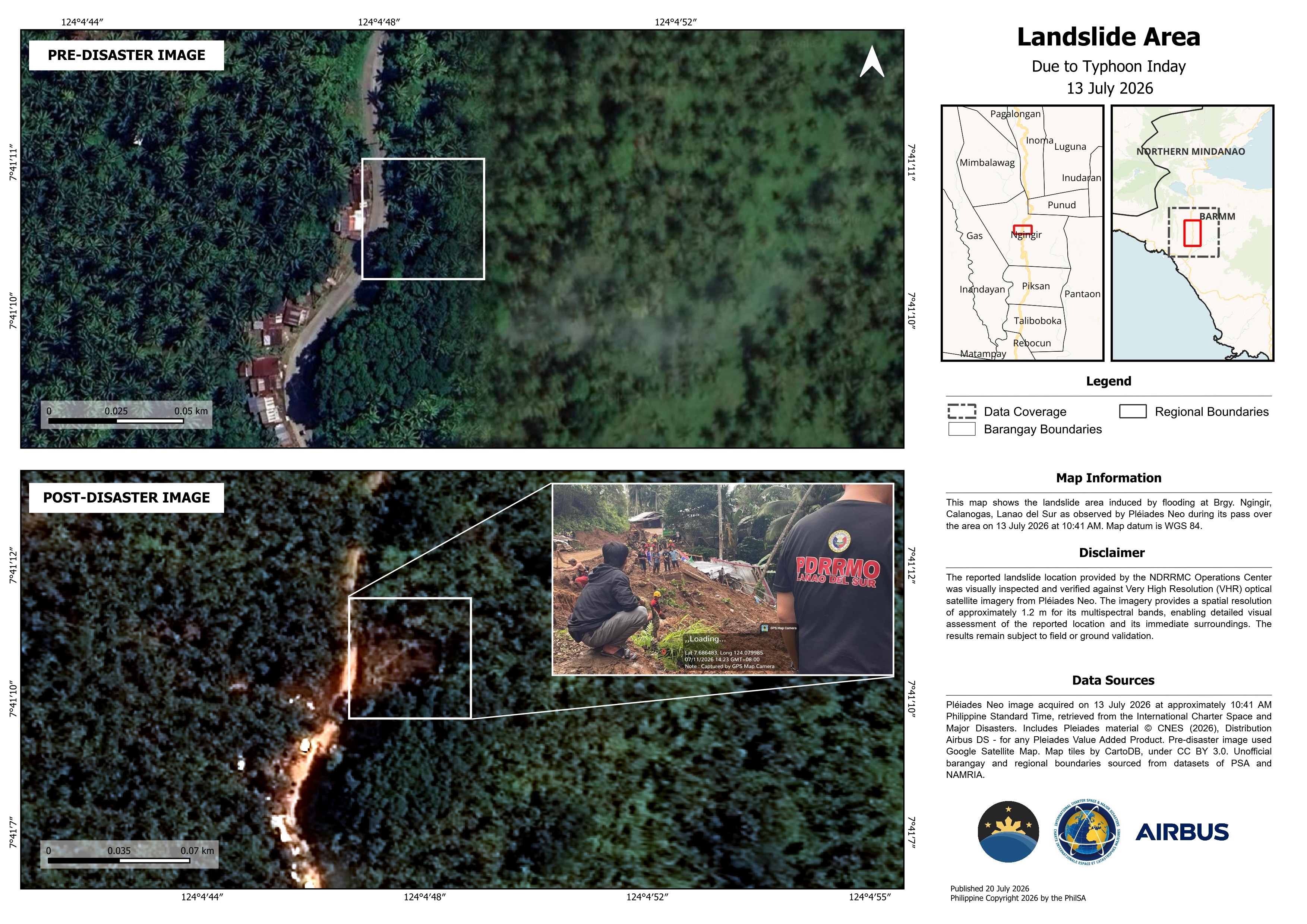
The Philippine Space Agency (PhilSA) on Tuesday released satellite maps showing the extent of flooding and a landslide caused by Typhoon Inday and the enhanced southwest monsoon this July.
In a news release, PhilSA compared pre-disaster and post-disaster satellite images of Barangay Ngingir in Calanogas, Lanao del Sur.
The side-by-side images, with the post-disaster image captured at around 10:41 a.m. on July 13, show trees that had fallen in the area due to a landslide triggered by heavy rains associated with Typhoon Inday.
Using Synthetic Aperture Radar (SAR) satellite imagery, the agency was also able to map the extent of flooding, particularly in CALABARZON and MIMAROPA.
“The flooded areas were detected by analyzing the signal values in the captured radar image and separating flooded areas from non-flooded areas,” PhilSA said.
The flood extent maps show flooded areas in red, flooded Physical Rice Areas in light pink, and flooded Other Crop Areas in old pink in Regions IV-A and IV-B following rains brought by the enhanced southwest monsoon due to Typhoon Inday.
According to PhilSA, the analysis used EOS-4 SAR satellite imagery from the Indian Space Research Organisation (ISRO), captured on July 14, 2026, at 6:05 p.m. Philippine Standard Time.
PhilSA said a similar analysis was conducted for Mindanao using data from the Canadian Space Agency. The analysis used an image captured by the RADARSAT Constellation Mission-1 (RCM-1) satellite on July 12 at 5:48 p.m.
“SAR satellite imagery is useful in flood mapping because SAR signals can penetrate through clouds that often cover large areas during storms, and regardless of daylight conditions, unlike optical imagery,” PhilSA said.
“However, SAR may underestimate flooding in urban and densely vegetated areas because complex surfaces may affect the backscatter data being measured and reduce flood detection accuracy. These maps remain subject to ground validation,” it added.
The maps may be accessed here:
PhilSA said the initiative supported the National Disaster Risk Reduction and Management Council (NDRRMC) in monitoring the situation and identifying priority areas for response through the analysis of wide-area satellite data.
PhilSA is the central government agency responsible for planning, developing, and promoting the country's national space program in accordance with the Philippine Space Policy.
It is an attached agency of the Office of the President for purposes of policy and program coordination and to ensure alignment with national policies and priorities. — MCG, GMA News

