

 GMA Brandtalk
 Tracking
 Archives

PhilSA maps flooding in Ilocos, Cagayan Valley due to Habagat, Maymay
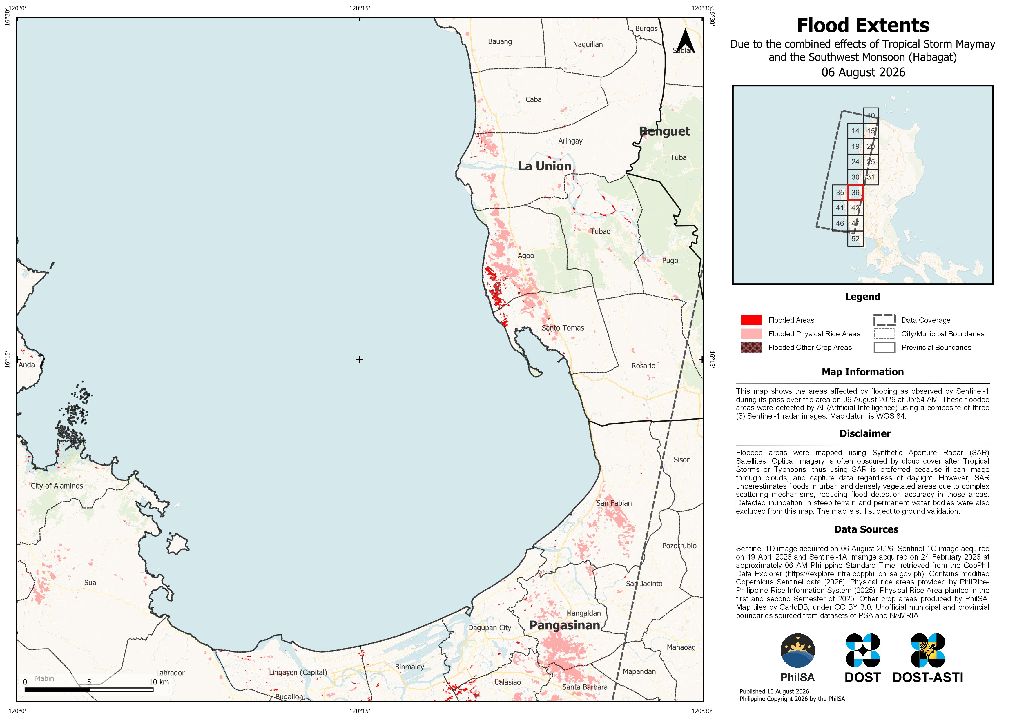
The Philippine Space Agency (PhilSA) has released a map showing the extent of flooding in the Ilocos Region and Cagayan Valley following heavy rains brought by the Southwest Monsoon (Habagat) and Tropical Storm Maymay.
PhilSA said satellite imagery captured flooded areas in the Ilocos Region on August 6 and in Cagayan Valley on August 9.
“The flooded areas were detected with the aid of Artificial Intelligence (AI) using a composite of three Sentinel-1 SAR images,” the agency said.
PhilSA said Sentinel-1 Synthetic Aperture Radar (SAR) satellite imagery can penetrate clouds and capture data regardless of daylight conditions, but noted that the technology has limitations.
“However, SAR may underestimate flooding in urban and densely vegetated areas because complex surfaces may affect the backscatter data being measured and reduce flood detection accuracy. Please note that these maps remain subject to ground validation,” PhilSA said.
According to the Office of Civil Defense, 19 people were reported killed and 15 others injured due to the combined effects of Tropical Cyclones Luis and Maymay and the enhanced Southwest Monsoon. — MCG, GMA News

