

Ineng to exit PAR Saturday; Signal No. 2 still up over Batanes, Babuyan
Tropical Cyclone Wind Signal No. 2 remains hoisted over Batanes and Babuyan Islands on Saturday even as Severe Tropical Storm Ineng (international name: Bailu) is expected to exit the Philippine Area of Responsibility (PAR) in the afternoon or evening, PAGASA said in its early morning forecast.
TCWS No. 1 on the other hand, is still up over Cagayan, Isabela, Apayao, Kalinga, Northern Abra and Ilocos Norte.
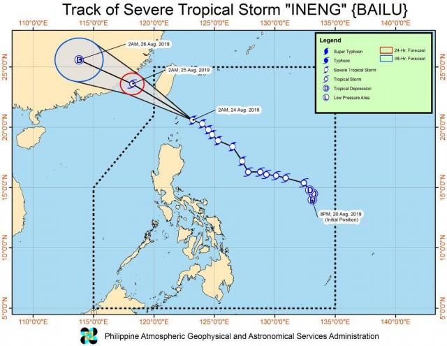
Ineng has slightly accelerated as it approaches southern Taiwan-Batanes Area.
As of 4 a.m., the center of Ineng was estimated at 105 kilometers east northeast of Basco, Batanes packing maximum sustained winds of up to 100 kilometers per hour near the center and gustiness of up to 125 kph and moving Northwest at 20 kph.
Ineng is expected to cross the Bashi Channel and will be closest to Batanes on Saturday morning.
It is expected to exit the PAR between late afternoon and early evening on Saturday.
On Saturday, moderate to heavy rains may prevail over Ilocos Region, Cordillera Administrative Region, Batanes, and Cagayan (including Babuyan Islands).
Light to moderate with intermittent heavy rains may be experienced over Metro Manila, Zambales, Bataan, Cavite, Laguna, Batangas, Rizal, Mindoro Provinces, northern portions of Palawan (including Calamian and Cuyo Islands), Aklan, Antique, Iloilo, and Guimaras.
Residents in the affected areas, particularly those in flash flood-prone and landslide-prone areas, are advised to take precautionary measures, coordinate with local disaster risk reduction and management offices, and continue monitoring for updates.
The weather bureau warned that areas under TCWS, especially those under higher TCWS, will have strong winds associated with Ineng. —BAP/KG, GMA News
