
Liwayway now a typhoon; Signal No. 1 remains over Batanes
Severe tropical storm Liwayway has intensified into a typhoon, according to PAGASA on Tuesday night.
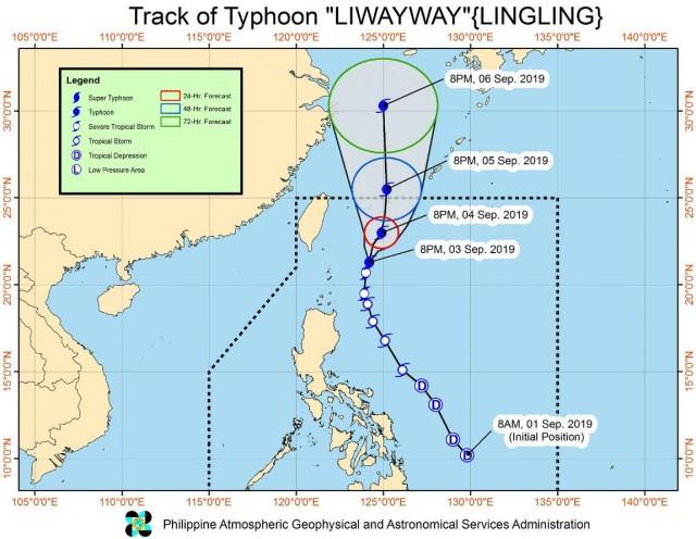
In its 11 p.m. bulletin, the weather service said that Tropical Cyclone Wind Signal (TCWS) No. 1 is still raised in Batanes. Residents of the province were advised to take precautionary measures against potentially strong winds.
The trough of Liwayway and the southwest monsoon will bring light to moderate with intermittent heavy rains over Batanes and Babuyan Islands between Wednesday evening and Thursday evening.
As of 10 p.m., Liwayway was located 265 kilometers east-northeast of Basco, Batanes packing maximum sustained winds of 120 kilometers per hour near the center and gustiness of up to 150 kph.
The typhoon has slowed down as it moves north-northeast at 10 kph.
PAGASA said the typhoon is not expected to make landfall and may exit the Philippine Area of Responsibility between Thursday afternoon and evening.
Meanwhile, the southwest monsoon or Habagat is likely to bring scattered light to moderate rains with at times heavy rain showers over Ilocos Region, Cordillera Administrative Region, Central Luzon, Calabarzon, Metro Manila, northern portions of Palawan (including Calamian Islands), and Mindoro provinces.
Residents in the affected areas were advised to prepare for possible flash floods and landslides.
PAGASA added that maritime travel remains risky over the seaboards of Luzon, including areas under TCWS No. 1, due to potential rough seas. — BAP, GMA News
