

Tropical Storm to enter PAR over the weekend
A tropical storm with the international name Kammuri, which is monitored by PAGASA, is expected to enter the Philippine Area of Responsibility (PAR) over the weekend.
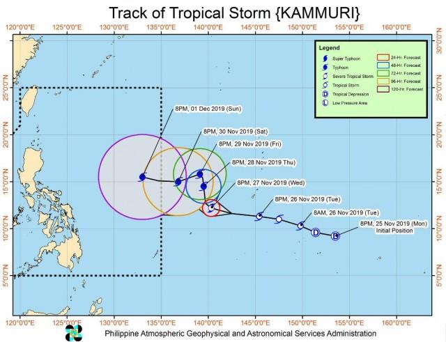
Kammuri has slightly intensified while moving westward over the Sea of Guam.
In the 11 p.m. bulletin, issued by the state weather bureau, the weather system was located 2,165 kilometers east of Visayas packing winds of up to 75 kilometers per hour and gustiness of up to 90 kph and continues to move westward at a speed of 40 kph.
By Wednesday evening, Kammuri is forecast to intensify into a Severe Tropical Storm and move closer to the east of Visayas.
By Thursday evening, the cyclone will become a typhoon and hover over the east of Southern Luzon.
By Friday evening, Kammuri is forecast to be 1,880 kilometers east of Central Luzon.
Once Kammuri enters PAR between Saturday evening and Sunday morning, the typhoon will be named “Tisoy.”
PAGASA advised all concerned disaster management offices to monitor updates on the cyclone.
The state weather agency defines a tropical storm as a cyclone that carries maximum wind speeds of 62 to 88 kph; a severe tropical storm packs winds between 89 to 117 kph; while a typhoon has winds of up to 118 to 220 kph. — BAP, GMA News
