

ITCZ to bring isolated rains on Sunday; LPA expected to cause rains Monday or Tuesday
The Intertropical Convergence Zone (ITCZ) or the area where the winds from the northern and southern hemisphere meet continues to affect Southern Mindanao on Sunday, PAGASA said in its early morning forecast.
Mindanao will thus have partly cloudy to cloudy skies with isolated rain showers mostly in the afternoon or evening.
Flash floods or landslides may occur during severe thunderstorms.
Meanwhile, Metro Manila and the rest of the country will also have partly cloudy to cloudy skies with isolated rain showers due to localized thunderstorms mostly in the afternoon or evening. Flash floods or landslides may possibly happen during severe thunderstorms.
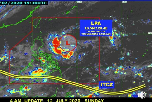
A low pressure area (LPA) located 720 km east of Tuguegarao City, Cagayan at 3 a.m. on Sunday is expected to bring rains over Northern Luzon on Monday or Tuesday.
Forecast temperature ranges for key areas on Sunday are as follows:
- Metro Manila: 25-32ºC
- Laoag: 25-32ºC
- Tuguegarao: 25-35ºC
- Baguio: 17-23ºC
- Legazpi: 27-34ºC
- Tagaytay: 23-30ºC
- Puerto Princesa: 25-31ºC
- Iloilo/Bacolod: 26-33ºC
- Metro Cebu: 24-31ºC
- Tacloban: 26-32ºC
- Cagayan de Oro: 23-31ºC
- Davao: 26-32ºC
- Zamboanga: 24-32ºC
Coastal waters will be slight to moderate in Luzon, and slight in Visayas and Mindanao.
Sunrise was at 5:34 a.m. while sunset will be at 6:30 p.m. —KG, GMA News
