

Leon intensifies as it moves over West Philippine Sea
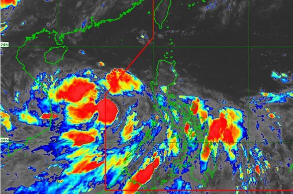
Tropical storm Leon continued to intensify as it moved northwestward over the West Philippine Sea, PAGASA said on Wednesday night.
In its 11 p.m. severe weather bulletin, the weather agency said that Leon is expected to intensify into a severe tropical storm within 12 hours and reach “peak intensity” on Friday, September 18.
At 10 p.m. on Wednesday, the center of Leon was estimated at 550 kilometers west northwest of Coron, Palawan or 380 kilometers north northeast of Kalayaan Islands, Palawan with maximum sustained winds of 85 kilometers per hour near the center and gustiness of up to 105 kph.
It is moving northwestward at 20 kph and is forecast to exit the Philippine Area of Responsibility on early Thursday morning.
Hazards affecting PHL
Though no Tropical Cyclone Wind Signal has been raised, intermittent gusts may be experienced over Batanes, Babuyan Islands, MIMAROPA, and Western Visayas due to the southwest monsoon, according to PAGASA.
On Wednesday night to Thursday, the monsoon is expected to bring light to moderate with, at times, heavy rains over MIMAROPA, Western Visayas, and Zamboanga Peninsula.
PAGASA warned of possible flooding and landslides in susceptible areas during heavy or prolonged rainfall.
Meanwhile, gale warnings have been raised over the western seabords of Palawan, including Kalayaan Islands, Occidental Mindoro, Zambales, and Bataan due to rough to very rough seas.
A severe weather bulletin on Leon will be issued at 11 a.m. on Thursday. -NB, GMA News
