

LPA develops into Tropical Depression Marce
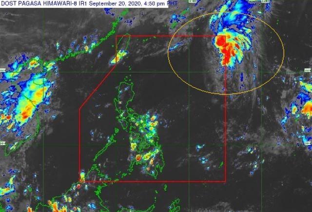
A low pressure-area east-northeast of extreme Northern Luzon has intensified into a Tropical Depression named “Marce,” PAGASA said Sunday afternoon.
In its 5 p.m. bulletin, the state weather bureau said Marce developed from an LPA at 2 p.m. Sunday.
At 2:00 PM today, the Low Pressure Area east northeast of Extreme Northern Luzon developed into Tropical Depression #MarcePH. Severe Weather Bulletins will be issued starting at 5:00 PM today. pic.twitter.com/PVu38ZC9eb
— PAGASA-DOST (@dost_pagasa) September 20, 2020
The cyclone was last seen 1,275 kilometers east-northeast of extreme Northern Luzon carrying maximum sustained winds of 45 kilometers per hour (kph) and gustiness of up to 55 kph.
Marce continues to move north-northwestwards at 15 kph. It is forecast to exit the Philippine Area of Responsibility on Sunday night or early Monday morning.
“This tropical cyclone is not expected to affect any land area or coastal waters of the country,” PAGASA said.
“Marce is forecast to remain a tropical depression throughout its lifespan. It is forecast to transition into an extratropical low on Tuesday,” it added.
By Monday afternoon, the tropical depression is expected to be 1,530 kilometers northeast of extreme Northern Luzon.
By Tuesday afternoon, it will be 1,750 kilometers northeast of extreme Northern Luzon. —LBG, GMA News
