
Signal No. 3 still up over Occidental Mindoro as Quinta moves westward —PAGASA
Tropical Cyclone Wind Signal No. 3 is still up over some parts of Occidental Mindoro as Typhoon Quinta maintains its strength and moves westward from the Mindoro Strait, state weather bureau PAGASA said Monday.
In its 11 a.m. bulletin, PAGASA said the northwestern portion of Occidental Mindoro such as Abra de Ilog, Mamburao, and Paluan, including Lubang Island, are under Signal No. 3.
Signal No. 2 was up over the following areas:
- Oriental Mindoro
- the rest of Occidental Mindoro
- Calamian Islands
- Batangas
- the extreme northern portion of Antique (Caluya)
Meanwhile, PAGASA said the following areas are under Signal No. 1:
- southern portion of Zambales (San Antonio, Castillejos, Subic, Olongapo City)
- Bataan
- southwestern portion of Pampanga (Floridablanca, Lubao, Sasmuan, Masantol)
- southwestern portion of Bulacan (Hagonoy, Paombong, Malolos City, Bulacan, Obando, Meycauayan City)
- Metro Manila
- Rizal
- Cavite
- Laguna
- Quezon including Polillo Islands
- Marinduque
- Romblon
- northern portion of Palawan (El Nido, Taytay) including Cuyo Islands
- Aklan
- the rest of the northern portion of Antique (Laua-An, Barbaza, Tibiao, Culasi, Sebaste, Pandan, Libertad
Due to Quinta, moderate to heavy with, at times, intense rains are expected over Occidental Mindoro, Oriental Mindoro, Romblon, Marinduque, northern Palawan including Calamian and Cuyo Islands, CALABARZON, Aurora, Isabela, Quirino, Mountain Province, Ifugao, Benguet, Aklan, Capiz, and Antique.
Moderate to heavy rains will be experienced over Cagayan, Apayao, Kalinga, Abra, Ilocos Norte, and Ilocos Sur due to the tail-end of a frontal system.
Due to the two weather systems, light to moderate with, at times, heavy rains are expected over Metro Manila, Western Visayas, Zamboanga Peninsula, Bangsamoro, Northern Mindanao, Caraga, and the rest of Luzon.
PAGASA warned of possible flooding including flash floods, and rain-induced landslides during heavy or prolonged rainfall in areas that are prone to these hazards.
In areas under Signal No. 3, destructive typhoon-force winds are expected. Areas under Signal No. 2 may experience damaging gale to storm-force winds, while strong breeze to near gale conditions in areas under Signal No. 1.
Due to the northeasterly surge, PAGASA said strong breeze to gale conditions will be experienced over Ilocos Region, Batanes, Cagayan, Apayao, and northern Zambales.
Rough to high seas (up to 7.0 meters) can be experienced over the seaboards of areas under a Tropical Cyclone Wind Signal.
The remaining seaboards of Luzon and the western, northern, and eastern seaboards of Visayas may have rough to very rough seas (up to 5.0 m).
“ Sea travel is risky for all types of sea vessels over these waters,” PAGASA warned.
The other seaboards of the country are expected to experience moderate to rough seas (up to 3.1 m).
“Mariners of small seacrafts are advised to take precautionary measures when venturing out to sea. Inexperienced mariners should avoid navigating in these conditions,” PAGASA said.
As of Monday morning, floods, landslides, and evacuations occurred in different parts of the country.
In Bauan, Batangas, seven people were rescued while one was missing after a yatch Ocean Explorer III sank at the height of Typhoon Quinta.
Binga Dam in Benguet, Magat Dam in Isabela, and Ipo Dam in Bulacan opened their gates to release water.
Classes have also been canceled due to the bad weather.
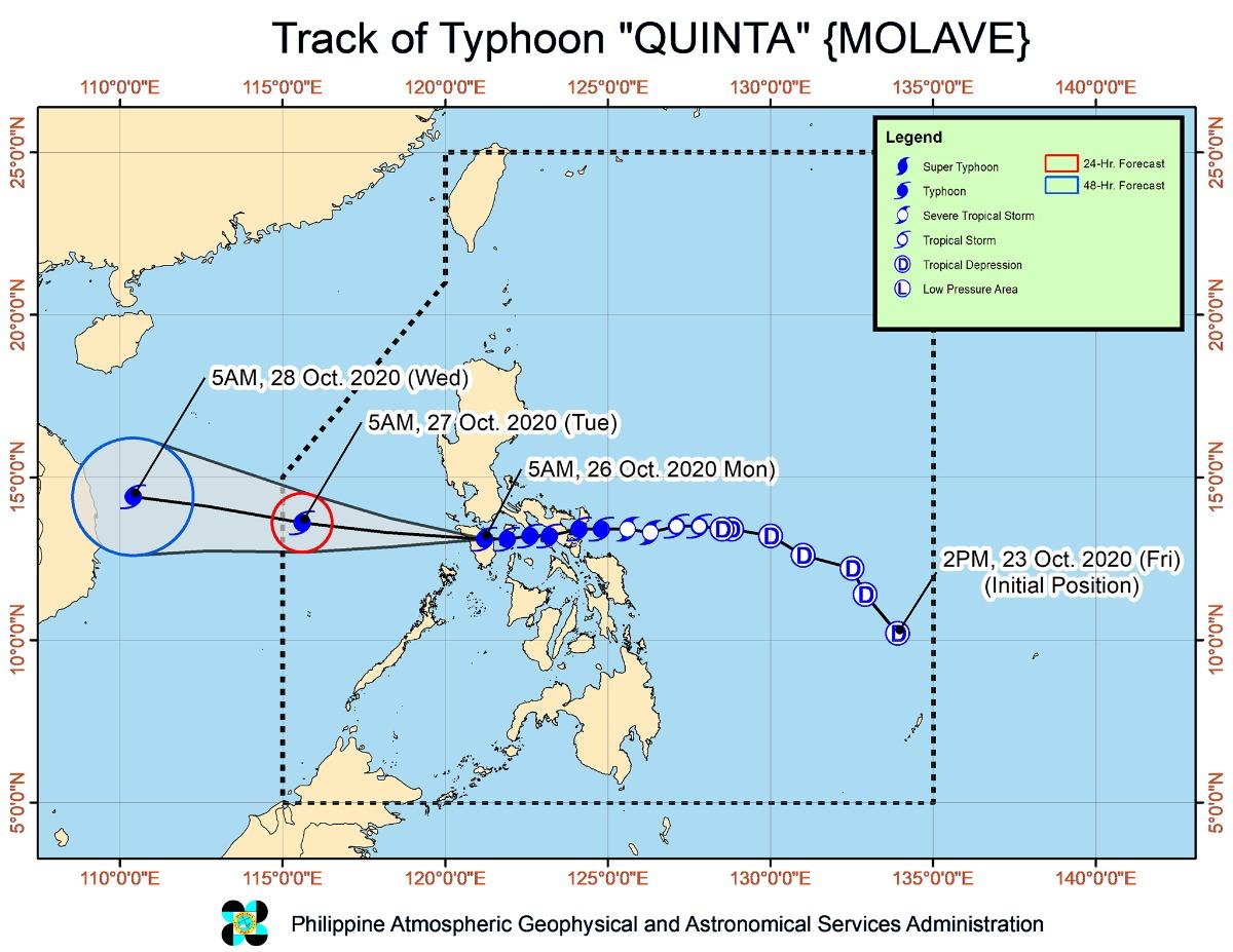
At 10 a.m., Quinta was located at 125 km north of Coron, Palawan with maximum sustained winds of 125 km per hour and gustiness of up to 150 km/h, moving westward at 25 km/h.
PAGASA said Typhoon Quinta will continue to move westward then will turn west-northwestward towards the western boundary of the Philippine area of responsibility. It is expected to exit PAR Tuesday morning.
Aside from Quinta, PAGASA is also monitoring a low pressure area (LPA) located at 1,920 km east of Southern Luzon.
PAGASA said the LPA may enter the PAR, but it has a low chance to develop into a tropical depression in the next two days.—AOL, GMA News
