

Siony about to pass over Batanes, landfall or close approach in next 3 hours
Severe Tropical Storm Siony is about to pass very close or over Batanes early Friday morning, according to the Severe Weather Bulletin posted by PAGASA.
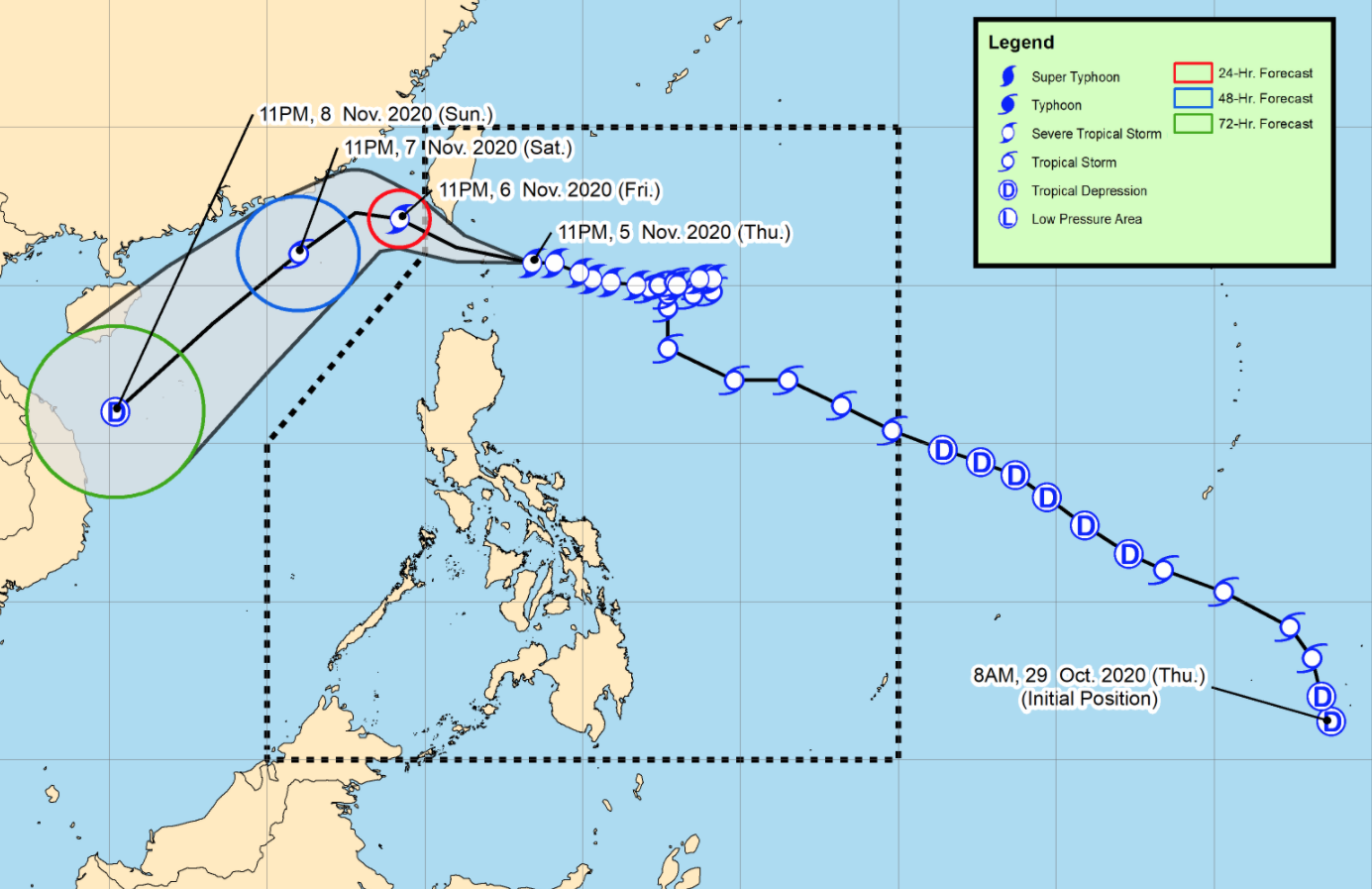
Siony is forecast to make landfall or close approach in the vicinity of Batanes within the next 3 hours as it continues to move west-northwestward and to exit the Philippine Area of Responsibility (PAR) on Friday afternoon or evening.
Siony will then turn southwestward by Saturday morning over the sea to the southwest of Taiwan and move over the West Philippine Sea towards the Paracel Islands area on Sunday.
Siony is forecast to either maintain its current strength or slightly intensify to 110 kilometers per hour within the next 24 hours.
Beyond this 24-hour window, the storm is forecast to significantly weaken due to increasingly unfavorable conditions associated with a surge of the northeasterlies over the West Philippine Sea. Siony may be downgraded to tropical depression category on Sunday.
As of 1 a.m. on Friday, the center of Severe Tropical Storm Siony was estimated at 125 kilometers east northeast of Basco, Batanes with maximum sustained winds of 100 kph near the center and gustiness of up to 125 kph and moving west northwestward at the speed of 25 kph.
Tropical Cyclone Wind Signal (TCWS) No.2 is hoisted over the following areas:
- Batanes
- Babuyan Islands
TCWS No. is raised over the following areas:
- the northern portion of mainland Cagayan (Santa Ana, Gonzaga, Lal-Lo, Allacapan, Santa Teresita, Buguey, Camalaniugan, Aparri, Ballesteros, Abulug, Pamplona, Sanchez-Mira, Claveria, Santa Praxedes)
- the northern portion of Apayao (Santa Marcela, Luna, Calanasan)
- the northern portion of Ilocos Norte (Adams, Pagudpud, Bangui, Dumalneg, Burgos, Vintar, Pasuquin, Bacarra)
Hazards affecting land areas
Areas under Tropical Cyclone Wind Signal (TCWS) No. 2 are currently experiencing damaging gale- to storm-force winds, while those under TCWS No. 1 are currently experiencing strong breeze to near gale conditions.
On Friday, the passage of Siony will bring moderate to heavy rains over areas under TCWS No. 2 and light to moderate with at times heavy rains over areas under TCWS No. 1.
Flooding (including flashfloods) and rain-induced landslides may occur during heavy or prolonged rainfall especially in areas identified in geohazard maps as highly or very highly susceptible to these hazards.
In the next 24 hours, minimal to moderate risk of storm surge of 1.0 to 2.0 meters over the coastal areas of Batanes and Babuyan Islands.
Hazards affecting coastal waters
In the next 24 hours, rough to high seas (3.0 to 8.0 m) will prevail over the coastal waters of areas where TCWS No. 2 and No. 1 are in effect while areas under gale warning will be experiencing rough to very rough seas (3.0 to 4.5 m).
Sea travel is risky over these waters for all types of seacrafts in areas under TCWS and for small seacrafts in areas under gale warning.
Moderate to rough seas (1.5 to 3.0 m) will be experienced over the western seaboard of Central Luzon and the eastern seaboards of Southern Luzon, Visayas and Mindanao.
Mariners of small seacrafts are advised to take precautionary measures when venturing out to sea. Inexperienced mariners should avoid navigating in these conditions.
Other tropical systems being monitored
The center of Tropical Storm Goni was estimated at 1,220 kilometers west of Southern Luzon outside PAR with maximum sustained winds of 65 kph near the center and gustiness of up to 80 kph and moving westward slowly towards the southern portion of Vietnam. PAGASA notes that this advisory is the final update for this tropical cyclone.
Meanwhile, the Low Pressure Area outside the PAR was estimated at 1,555 kilometers east of Visayas and forecast to move generally west-northwestward or northwestward and may enter the PAR on Friday afternoon or evening.
The LPA is heading towards the direction of Eastern Visayas and may likely reach the area tomorrow afternoon or evening. This weather disturbance may develop into Tropical Depression Tonyo within the next 48 to 72 hours.
